DAVIDSON COUNTY FORECAST
Good evening Davidson County!
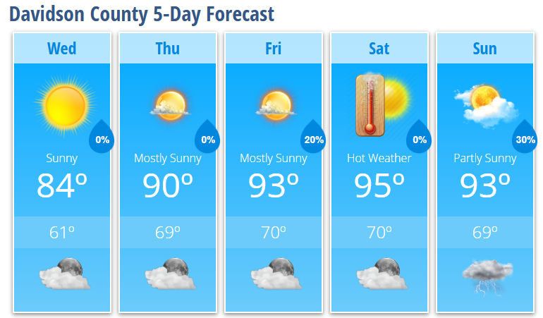
A refreshing change is arriving behind today's cold front. Lower humidity and cooler temperatures will make Wednesday one of the nicest days we've seen in quite some time. Unfortunately, the relief is short-lived as summer heat quickly returns by the end of the week.
WEDNESDAY
Sunny
High: 84°
Light north wind
Comfortable humidity
WEDNESDAY NIGHT
Mostly clear
Low: 61°
THURSDAY
Mostly sunny
High: 90°
South wind 5-7 mph
THURSDAY NIGHT
Mostly clear
Low: 69°
FRIDAY
Mostly sunny
High: 93°
20% chance of an afternoon shower or thunderstorm
FRIDAY NIGHT
Partly cloudy
Low: 70°
SATURDAY
Mostly sunny and hot
High: 95°
SATURDAY NIGHT
Partly cloudy
Low: 70°
SUNDAY
Partly sunny
High: 93°
30% chance of afternoon thunderstorms
WHAT I'M WATCHING
Wednesday will be the standout day of the forecast. Sunshine, lower humidity, and highs in the mid-80s will provide a welcome break from the recent heat.
Temperatures steadily climb through the remainder of the week. Highs return to 90° Thursday before reaching the lower to middle 90s Friday through Sunday.
Heat index values will likely climb above 100 degrees this weekend. While temperatures have trended slightly lower than earlier forecasts, the combination of heat and humidity will still create uncomfortable conditions during the afternoon hours.
Isolated afternoon and evening storm chances return Friday and continue through the weekend. Most locations will stay dry, but any storm that develops could produce brief heavy rain and lightning.
BOTTOM LINE
Wednesday is the day to enjoy the outdoors. After that, Davidson County heads back into a classic late-June weather pattern featuring increasing heat, rising humidity, and scattered afternoon storm chances by the weekend.
-
Steve Monday
Chief Forecaster
Davidson County Weather -