DAVIDSON COUNTY FORECAST
Tuesday, June 23, 2026
Good morning Davidson County!
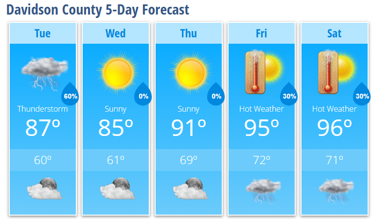
A cold front will move through the region today, bringing showers and thunderstorms through the morning hours before conditions improve this afternoon. While the highest severe weather threat remains east of the Triad, Davidson County could still see a few stronger storms capable of producing gusty winds before the front moves through.
TODAY
Showers and thunderstorms likely, mainly before 11 AM
Partly sunny this afternoon
High: 87°
Southwest wind becoming northwest
Wind gusts up to 18 mph
TONIGHT
Mostly clear and cooler
Low: 60°
WEDNESDAY
Sunny and pleasant
High: 85°
Comfortable humidity levels
WEDNESDAY NIGHT
Mostly clear
Low: 61°
THURSDAY
Sunny and warmer
High: 91°
FRIDAY
Mostly sunny and hot
High: 95°
Slight chance of storms Friday night
SATURDAY
Mostly sunny and very hot
High: 96°
30% chance of afternoon and evening storms
WHAT I'M WATCHING
Today's storms should be most active during the morning hours before gradually shifting east. Gusty winds remain the primary concern with any stronger thunderstorms.
A beautiful stretch of weather arrives Wednesday and Thursday with sunshine, lower humidity, and seasonable temperatures.
Summer heat returns in a big way heading into the weekend. High temperatures climb into the mid-90s Friday and Saturday, with heat index values potentially reaching 100 to 105 degrees by Sunday.
Bottom Line:
Today's storms clear out by this afternoon, setting up two excellent weather days for Wednesday and Thursday. After that, Davidson County heads back into a significant stretch of summer heat as we move toward the weekend.