What Time Will Strong Storms Arrive Today? County-by-County Breakdown
One of the biggest questions I'm receiving today is simple: When will the storms arrive?
While not everyone will see a thunderstorm, conditions are favorable for scattered storms to develop over the mountains this afternoon and move east across the Piedmont during the evening hours. Some of these storms could become strong to severe with damaging wind gusts being the primary threat.
Here's what I'm watching for Rowan, Davie, and Davidson counties.
Overall Setup
A cold front will approach from the northwest today while temperatures climb into the lower and middle 90s. The combination of heat, humidity, and an approaching disturbance in the upper atmosphere will help fuel thunderstorm development.
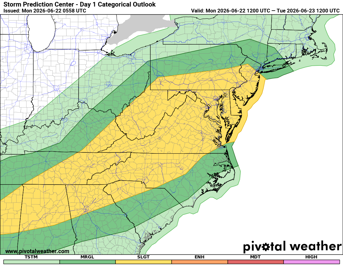
The Storm Prediction Center continues to place our area under a Slight Risk (Level 2 of 5) for severe weather.
The primary threats include:
- Damaging straight-line winds
- Frequent lightning
- Heavy rainfall
- Isolated hail
At this time, the tornado threat appears very low.
Rowan County
Expected Arrival Window
4 PM to 8 PM
The first storms could begin approaching western portions of Rowan County as early as 4 PM, with the highest coverage expected between 5 PM and 8 PM.
Strongest Storm Window
5 PM to 9 PM
This is the period when storms will have the greatest access to daytime heating and instability.
Rainfall Expectations
- Most locations: 0.25" to 0.50"
- Isolated amounts: 1" to 2" possible
When Storms End
Most activity should weaken and move east by 10 PM to Midnight.
Davie County
Expected Arrival Window
4 PM to 7 PM
Davie County may be among the first locations in our coverage area to experience thunderstorms this afternoon.
Strongest Storm Window
4 PM to 8 PM
Damaging wind gusts would be the primary concern with any stronger storms.
Rainfall Expectations
- Most locations: 0.25" to 0.50"
- Locally higher totals under stronger storms
When Storms End
Most storms should move out between 9 PM and Midnight.
Davidson County
Expected Arrival Window
5 PM to 9 PM
Storms should arrive slightly later across Davidson County as activity pushes southeast across the region.
Strongest Storm Window
6 PM to 10 PM
This is when I expect the best chance for stronger thunderstorms capable of producing damaging wind gusts.
Rainfall Expectations
- Most locations: 0.25" to 0.50"
- Isolated pockets of 1" to 2" possible
When Storms End
Most storms should weaken and exit the county before Midnight.
The Biggest Concern: Damaging Winds
Today's atmosphere favors thunderstorms producing strong wind gusts as they move east from the mountains.
If a storm warning is issued for your location, be prepared for:
- Downed tree limbs
- Isolated power outages
- Blowing unsecured outdoor items
- Brief periods of very heavy rain
Now is a good time to secure lightweight outdoor furniture, umbrellas, and other loose objects.
The Good News
Once the cold front moves through tonight, a much more comfortable air mass arrives.
Tuesday through Thursday will feature:
- Lower humidity
- High temperatures in the upper 80s
- Comfortable mornings in the lower 60s
- Plenty of sunshine
I'll be monitoring radar trends throughout the afternoon and evening and will provide updates if stronger storms begin organizing west of the area.