Potential Tropical Cyclone One Could Bring Heavy Rain, Gusty Winds to Rowan County Late This Week
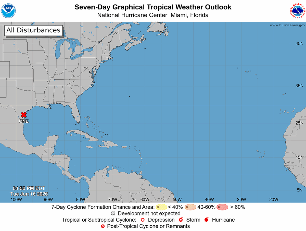
SALISBURY, N.C. — I'm closely monitoring Potential Tropical Cyclone One, which was designated Tuesday morning in the western Gulf of Mexico. While direct tropical impacts are not expected across North Carolina, the system could still bring periods of heavy rain, gusty winds, and thunderstorms to Rowan County and surrounding areas Thursday night through Friday.
Based on the latest forecast guidance, the system is expected to track along a stalled frontal boundary across the Deep South before lifting northeastward later this week. Current projections keep the center of the system well south and west of North Carolina, but moisture associated with the system will be drawn northward into the Carolinas.
Heavy Rain Remains the Primary Concern
The greatest weather concern at this time appears to be the potential for periods of heavy rainfall beginning Thursday afternoon and continuing through Friday. Forecast models continue to show the heaviest rainfall axis generally south of Rowan County, but even small shifts in the storm track or frontal boundary could bring heavier rainfall farther north.
Current forecast trends suggest isolated flooding cannot be ruled out, especially in low-lying or poor-drainage areas if heavier rain bands develop over the region. While recent rainfall has helped ease drought conditions across parts of the area, it has also increased the potential for runoff if rainfall rates become excessive.
One piece of encouraging news is that the latest guidance has shifted the axis of the heaviest rainfall farther south compared to earlier forecasts. However, confidence remains lower than normal, and additional adjustments are possible over the next 24 to 48 hours.
Severe Weather Threat Being Monitored
In addition to heavy rain, I'll be watching for the possibility of a few strong to severe thunderstorms Thursday afternoon through Friday.
Based on the latest National Weather Service briefing and forecast guidance, if the remnant circulation from Potential Tropical Cyclone One tracks in a favorable position, enhanced wind shear could develop across portions of the Carolinas. That setup could support isolated damaging wind gusts within stronger thunderstorms. Confidence remains low regarding the exact track of the remnant system, but it is something worth monitoring closely over the next couple of days.
Another round of stronger thunderstorms may be possible Friday afternoon as a cold front moves through the region. Damaging winds would be the primary concern, although isolated hail larger than one inch in diameter cannot be completely ruled out.
Gusty Winds Expected Thursday
Even outside of thunderstorms, Thursday is expected to be a windy day across much of the Piedmont.
Southwest winds will increase throughout the day with sustained speeds of 15 to 20 mph possible at times. Wind gusts between 25 and 35 mph may occur during the afternoon and evening hours. These winds are not directly related to Potential Tropical Cyclone One but instead are being generated by the overall weather pattern developing ahead of an approaching cold front.
Residents may want to secure lightweight outdoor items, including trash cans, patio furniture, umbrellas, and decorations that could be blown around by stronger gusts.
What This Means for Rowan County
For now, Wednesday remains quiet with sunshine and temperatures near 90 degrees. Thursday will turn hotter and breezier, with highs reaching the lower 90s before rain chances begin increasing late in the day.
The highest likelihood for widespread showers and thunderstorms arrives Thursday night into Friday. While there is still uncertainty regarding rainfall totals and storm intensity, residents should prepare for the possibility of heavy downpours, gusty winds, and periods of lightning.
At this time, I do not see any indication of direct tropical impacts in Rowan County. However, the combination of tropical moisture, a stalled frontal boundary, and an approaching cold front could create a period of active weather late this week.
I will continue monitoring forecast trends, National Weather Service briefings, and the latest model guidance over the next several days. As confidence increases, I'll provide additional updates through Rowan County Weather regarding any flooding, wind, or severe weather concerns ahead of the Juneteenth holiday.