
Strong Thunderstorm Moving Through Davie & Northern Rowan Counties Until 4:15 PM
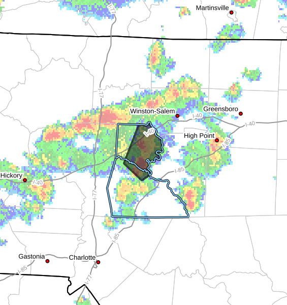
A strong thunderstorm is moving across portions of Davie County and northern Rowan County this afternoon, bringing gusty winds, heavy rain, lightning, and the potential for small hail.
As of 3:30 PM, Doppler radar indicated a strong thunderstorm located near Cooleemee, or about 5 miles southeast of Mocksville, moving northeast at around 15 mph.
Main Threats
- Wind gusts up to 40 mph
- Half-inch hail
- Heavy downpours
- Frequent lightning
While this storm remains below severe thunderstorm warning criteria, it is capable of producing locally strong wind gusts that could knock down small tree limbs and blow around unsecured outdoor objects. Minor hail damage to outdoor items is also possible.
Areas Impacted
Communities that could be impacted through 4:15 PM include:
- Mocksville
- Bermuda Run
- Cooleemee
- Fork Church
- Advance
- Farmington
- Woodleaf
- Northern Rowan County
What To Expect
This storm is part of the scattered afternoon thunderstorm activity developing across the western Piedmont today. Storms remain hit-or-miss, but any stronger cell can quickly produce dangerous lightning and brief heavy rainfall.
If you are outdoors, now is a good time to move inside a sturdy building until the storm passes.
Rowan County Weather will continue monitoring radar trends through the afternoon and evening.