
Strong Thunderstorms Moving Across Davidson County Through 10:30 AM
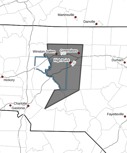
Strong thunderstorms are moving across portions of the central North Carolina Piedmont this morning, including Davidson County, according to the National Weather Service.
The storms are expected to continue impacting the area through 10:30 AM EDT.
Storm Location and Movement
At 9:48 AM, Doppler radar indicated a line of strong thunderstorms extending from near Woodville to China Grove, moving east at 45 mph.
This fast-moving line of storms will continue pushing east across the region through the late morning hours.
Main Hazards
The strongest storms may produce:
-
Wind gusts up to 50 mph
-
Pea-sized hail
Potential Impacts
These storms could produce gusty winds capable of knocking down tree limbs and blowing around unsecured objects.
Small hail may also cause minor damage to vegetation.
Communities Impacted
Communities that may experience impacts from these storms include:
-
Lexington
-
Thomasville
-
Greensboro
-
Winston-Salem
-
High Point
-
Asheboro
-
Albemarle
-
Randleman
-
Badin Lake
-
Kernersville
Storms moving through Davidson County, including Lexington and Thomasville, may bring brief periods of strong winds and heavy rain.
Major Highways Impacted
Drivers along several major highways may encounter heavy rain and gusty winds, including:
-
Interstate 85 between Mile Markers 84 and 125
-
Interstate 40 between Mile Markers 182 and 223
-
Interstate 73 between Mile Markers 63 and 103
-
Interstate 74 between Mile Markers 56 and 79
Motorists should use caution as storms move across the region.
Tornado Watch Remains in Effect
A Tornado Watch remains in effect until 2:00 PM EDT for central North Carolina, meaning conditions remain favorable for severe thunderstorms and possible tornado development.
Safety Reminder
If storms approach your location and you are outdoors, seek shelter inside a sturdy building until the storms pass.
Rowan County Weather will continue monitoring radar and National Weather Service updates and will provide additional updates as storms move across the region.