
Severe Thunderstorm Warning Issued for Rowan and Davie Counties Until 10:30 AM
The National Weather Service in Greenville-Spartanburg has issued a Severe Thunderstorm Warning for Rowan and Davie counties.
The warning is in effect until 10:30 AM EDT.
Storm Location and Movement
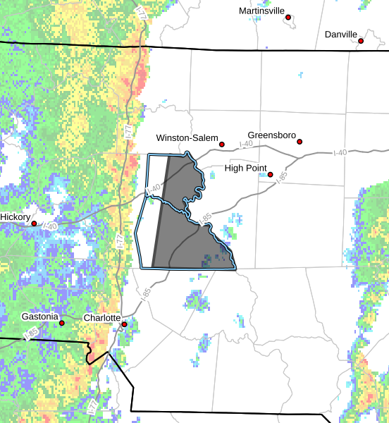
At 9:34 AM, Doppler radar indicated a line of severe thunderstorms extending from near Yadkinville to northeast of Huntersville, moving east at 45 mph.
This fast-moving line of storms will continue pushing across the region through the late morning hours.
Main Hazard
The primary threat with this storm line is:
-
Wind gusts up to 60 mph
Potential Impacts
Strong winds could:
-
Knock down trees and tree limbs
-
Damage power lines
-
Cause scattered power outages
Residents should be prepared for rapidly changing weather conditions as the storms move through.
Communities Impacted
Communities in the warning area include:
-
Salisbury
-
Mocksville
-
China Grove
-
Spencer
-
Landis
-
Enochville
-
Granite Quarry
-
Rockwell
-
Bermuda Run
-
Cooleemee
Storms will move quickly from west to east, meaning impacts could occur with little warning once the line arrives.
Safety Reminder
If severe storms approach your location:
-
Move to an interior room on the lowest floor of a sturdy building
-
Stay away from windows
-
Remain sheltered until the storm passes
Report Storm Damage
The National Weather Service encourages residents to report damaging winds, hail, or flooding.
Reports can be made by calling 1-800-267-8101 or by posting on social media using #nwsgsp with the location and description of the event.
Rowan County Weather Will Continue Monitoring
Rowan County Weather will continue monitoring radar and National Weather Service updates and will provide additional updates if warnings are extended or new storms develop across the area.
Please let our local sponsors know that you appreciate their support of our blog. Take a moment to visit their website linked at the top of this post.
Share this:

Announcements & Events
Check back often for important announcements and events that I'll be involved in!