

A slight possibility of a wintry mix around the county next weekend.
As I mentioned yesterday. I am watching for the slight potential of a wintry mix around the county next weekend. There is still a lot of uncertainty with this system as we are several days out. However, in my opinion this system has a better chance than the previous system that brought ice to areas south and east of us in December. The models are continuing to stay in agreement with the possibility of some winter weather next weekend in the southeast. The window looks to be very brief at this point. Yesterday the models started to move away from any activity on Friday to the moisture moving in later in the weekend. Things appear to be more favorable for late Saturday evening to early Monday morning. Let's take a look at two of the models showing the possibility of precipitation.
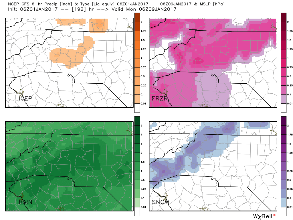
The model above is from the GFS model. Now as I have stated before this model tends to be very aggressive with precipitation in terms of amounts. It's pretty good at giving you a fair indication of what precipitation may fall over a period of time. Based on the model data above the GFS is leaning more toward a rain/freezing rain event around the county at this time. There is a chance we could see some sleet mixing in as well. Snow at this point for the GFS stays to our west. This would be from a period of late Saturday evening to early Monday morning.

The image above is from the European model which does a much better job at handling these type of events in terms of accumulation. The European model is continuing to lean toward an event starting with all rain. Transitioning over to snow for a period of time and then back to rain by the time all is said and done.
My biggest concern with all of the data is that we stand an ever so slight chance at this point of seeing a brief window of a mixed bag of precipitation. Now please remember as I stated yesterday. There is no need for any real concern at this point. Don't rush to the store for milk and bread. This is still several days out and things can and probably will change with each model run. I will continue to track the models and provide updates right here on the website throughout the upcoming week. As always thank you for following Rowan County Weather!