
Slight possibility for a brief Wintry Mix next weekend
There is a very slight possibility for a brief wintry mix next weekend here in the county. The event is still several days away so plenty could change and most likely will. However, the models runs for this system certainly has my attention. If you have followed my post for any amount of time you know I don't like to hype weather up. For me to buy into something it takes a certain amount of confidence in the models. I am seeing a little bit of agreement with the models this morning that makes me think we could see around a 30% chance of a brief period of a mix of rain and snow between early Friday morning and early Sunday morning around the county. I do not see this occurring for any real length of time at this point. As I stated this appears to be a brief period of time. Let me type this in bold letters and be as clear as possible. I would not plan on a milk and bread run for this system at this point. If we get any accumulation of snow it is going to be very light trace amounts.
Let me show you the data that has me buying into the brief period of a rain snow mix for next weekend. There are two main models that tend to handle these events pretty well. The first is the GFS Model. Now this model does a better job with temperatures and other variables than it does precipitation so it tends to over emphasis precipitation amounts. Below is some model data form the GFS that shows the possibility of a rain snow mix next Friday morning.
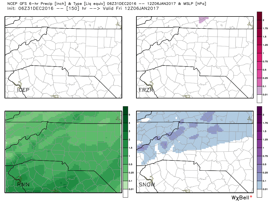
This is for a time period of around 7am next Friday morning. The only quadrants for precipitation types in this model that show anything are the bottom two quadrants that show rain on the left and snow on the right. Now if you look the chances for rain are much higher based on the amount of green showing in that particular window. As you can see from the bottom right quadrant there is a chance for a brief mix of snow during the early morning hours on Friday for areas west of Interstate 85 in the county.
Now let's take a look at the European Model and what it is showing. The European Model does a fantastic job with calling out precipitation for these type of events.
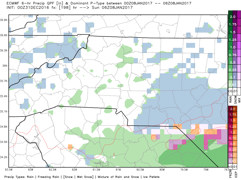
Now as you can see from the picture above the European model is showing a brief period of a rain snow mix on early Sunday morning at around 1am. However, there is a much lower chance as the air appears to be much drier at that point and the precipitation seems to be concentrated more toward the extreme southeastern corner of the county. I am not going to break out the snow meter on this system yet as the confidence level is still low. However, if we are still talking about this system in another 24-48 hours. The Rowan County Weather Snow meter could make its debut for this system as we get closer to next weekend.
Again this is not going to be a system at this point that will cause any disruption for anyone around the county as their is still a big level of uncertainty with the system. At this point its more of a conversation point that will most likely lead to a lot of social media chatter.
I will keep you updated as the model runs continue to come in on this system over the next few days. As of right now this system is our first chance to potentially see a snowflake or two somewhere in the county. As always thank you for following Rowan County Weather!
Please let our local sponsors know that you appreciate their support of our blog. Take a moment to visit their website linked at the top of this post.
Share this:

Announcements & Events
Check back often for important announcements and events that I'll be involved in!