
Update on the Freezing Rain Potiential
Hi everyone! I wanted to come back on real quick and give you the latest update on the Freezing Drizzle potential that is still being talked about around the area. I am continuing to check the models and I stand by more forecast I have provided all week for this event. The air is really dry and by the time things get saturated enough the temperatures are going to be above freezing. This continues to look to me like it has from the beginning of all of this. A cold rain event! Here are what the latest models are indicating.
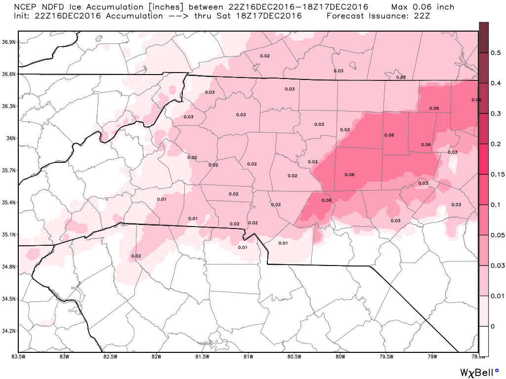
The GFS

This model has been pretty spot on for this event all week long. If you read my earlier blog post freezing rain was likely to the east of us. The latest model run is showing a very isolated area of freezing rain to our east and a small area in western NC. Otherwise, this model is leaning toward some isolated rain through the early morning hours.
The NAM
This model has been very aggressive with the accumulation all week long. That is typical of NAM Models they do well with Temperatures and Cloud cover but not so well with precipitation. I feel a lot of people are giving this model more credit than it deserves for this system.
The HRRR
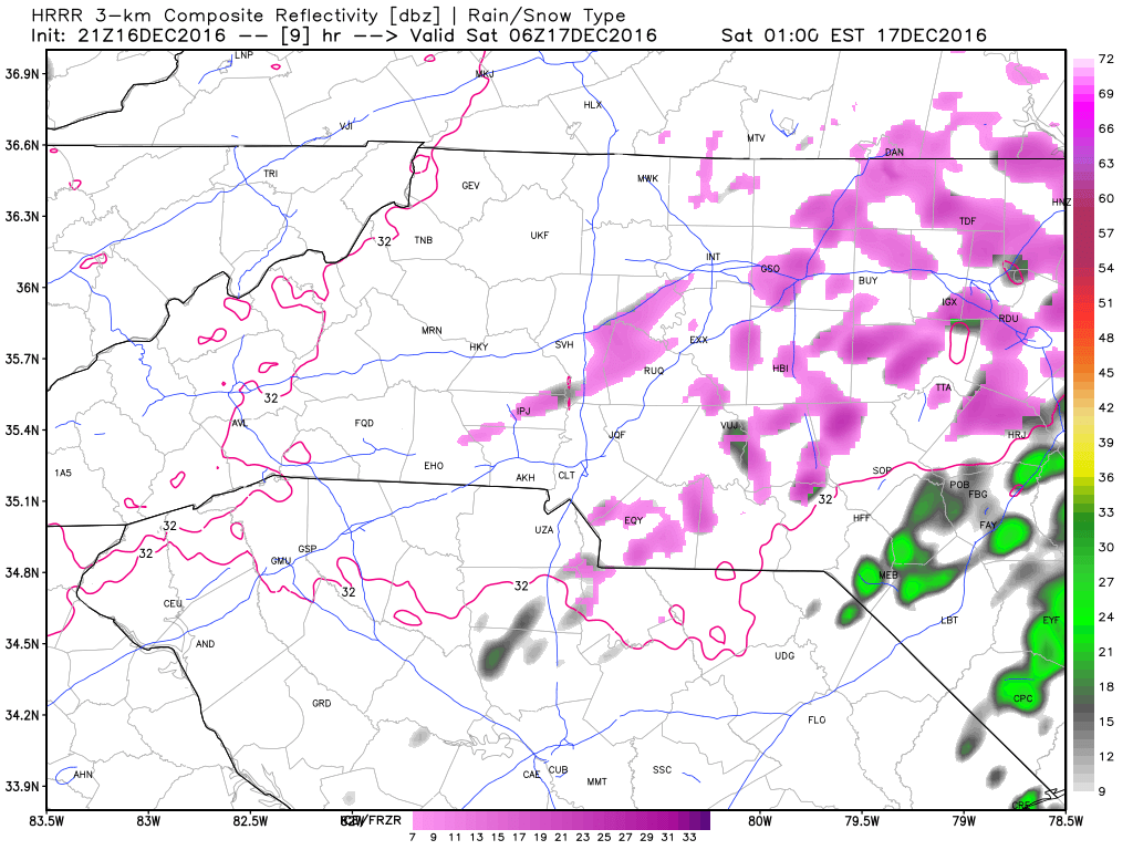
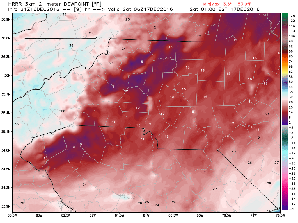
This is the latest short range model update. If you look at the hour by hour. There are plenty of areas of freeing precipitation that passes over the county. This image seems to be the most active period of the overnight hours. The main impact that I think keeps us dry and away form the frozen precipitation is the dew points. The air is really dry. Until you can get the dew point and the air temperature to almost match it is very difficult for precipitation to reach the ground. If you look at the image below the dew points at around 1am are 16º The image above is also form 1am showing the most active period of the overnight hours for precipitation. The air in my opinion will remain too dry for the precipitation to reach the ground.
I feel that the precipitation for the overnight hours will occur to our east. Areas around Raleigh and along the 95 corridor have the better chance for frozen precipitation. We will have a cold rain here in Rowan County. I will post one more update later this evening to give you a fresh look at the overnight hours. As always thank you for following Rowan County Weather!