
Winter Weather Weekend Update
I continue to see things trending downward on the chance for winter weather this weekend for Rowan County. I have stated from the beginning I just don't see the ingredients coming together for this to occur. I continue to stand by that pledge. If you look at the GFS Model below which is the model that has had the best handle on the threat. There continues to be signs of this not occurring at all in Rowan County.
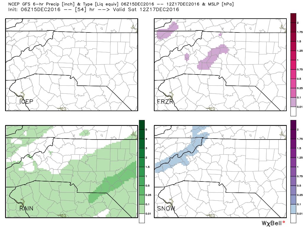
The above model has four quadrants that show the different precipitation types that are likely. The trends in this model have not changed any since the beginning of this week.
- Top Left: Ice Chances have been and continue to remain at 0%
- Top Right: Freezing Rain. The pink in this model has continued to get smaller and smaller as we have gotten closer to the weekend. Overall Rowan County has around a 1% chance of seeing freezing rain this weekend.
- Bottom Left: Rain. This has been the most consistent type of precipitation with this event. The timing of the moisture arriving and actually reaching the ground has continued to make me believe that this will be a cold rain event.
- Bottom Right: Snow. The chance for snow with this event has and continues to be only likely on the western facing slopes at the TN/NC border.
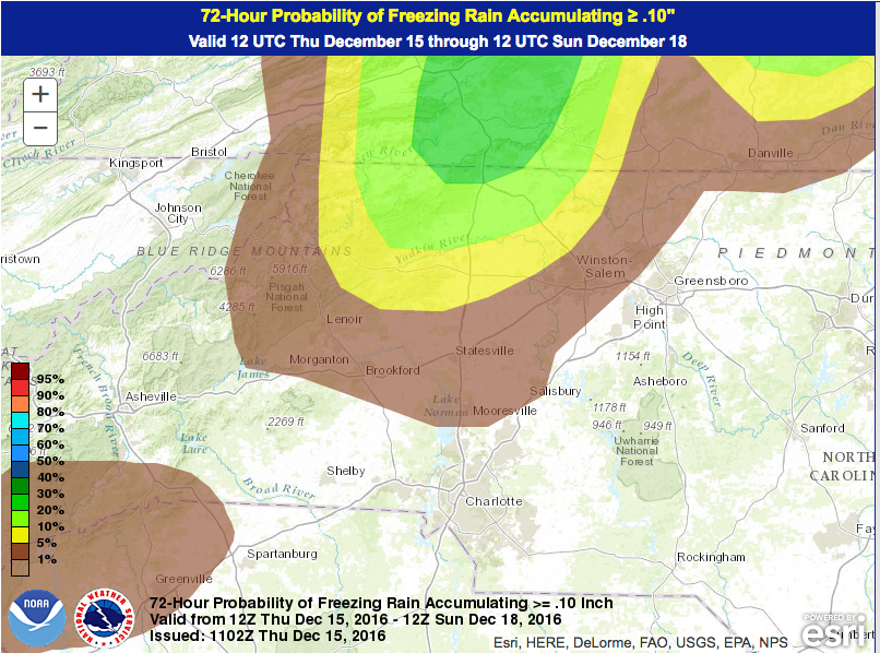
If you look at the probabilistic model above. The gradient continues to get smaller and shifts more to a very defined area northwest of the county. We have around a 1% chance of seeing any type of frozen precipitation from this event this weekend. I will post another update about this tomorrow as keep you updated as precipitation starts to move into the area on Saturday. As always thank you for following Rowan County Weather!