
Rumor of Snow Next Weekend Not Likely
There are some social media outlets who like to look at long range models and try to paint a picture of gloom and doom along with wish casting. The problem with sites like that is they gain a lot of attention from post shares that tend to get people concerned with the reality f what they are forecasting. I spend quite a bit of time ahead of these rumored events having to explain why I am not seeing the same thing in my forecast. The idea behind legitimate forecasting is to take all models in consideration and dispelled the bad data in models from your forecast and trust the good data that is also trending in the majority of the models. So with that said with the forecast models for next weekend there is quite a bit of uncertainty I am going to show you examples form two of the main models for forecasting and show why at this point. I am not seeing a real legitimate threat for winter weather.
The GFS Model
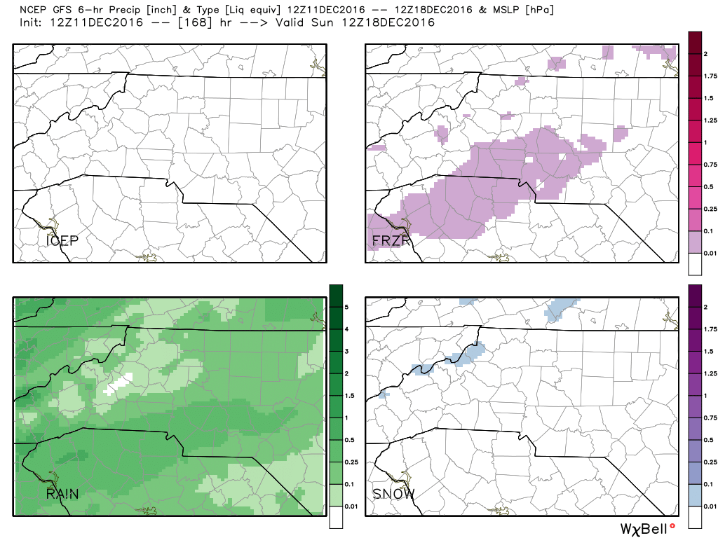
In looking at the possible precipitation types for next weekend on the GFS Model you can see from the picture above the boxes from top left to bottom right indicate some form of precipitation.
- Top Left is the box that would indicate icy precipitation. As you can see there is nothing showing that box for frozen precipitation.
- Top Right frozen precipitation you can see that their is a pink area of precipitation showing over Rowan County for next weekend.
- Bottom Left rain/ As you can see most of the area is showing indications of a cold wet rain next weekend.
- The Bottom Right box indicates Snow. As you can tell from that box only some western facing slopes may see some snowfall next weekend.
Now one could eliminate all of the other pictures above and just show the picture for the possibility of frozen precipitation next weekend and issue a blog post or forecast indicating a the chance for winter weather next weekend. I take many other factors to utilize for my forecast and I will explain those in a moment.
The ECMWF Model
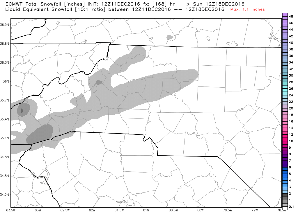
As you can see from the ECMWF Model pictured above for next weekend there is the likely hood of a trace of wintry precipitation in the county next weekend but that would only be in the northwest portion of the county.
Now as I stated earlier I take many other factors in consideration for my forecast. The air aloft, you have to take into account the temperature for the air aloft in the event its a warm nose of air that will cause the precipitation to fall as all rain. The timing of the precipitation moving into the county. Right now the timing of the precipitation in the models indicates the precipitation will arrive while the temperatures are too warm for wintry precipitation to fall. The position of High & Low Pressure in the area. The position of a front could easily have an affect on if the air is to dry for any precipitation to reach the ground.
All in all what I am telling you at this point is. If you see information on social media indicating wintry weather for next weekend. It's likely those outlets are not giving you the full picture. Many outlets will do this for site hits which provides revenue for the organization they are a part of. My concern is more about credibility and providing the residents of Rowan County with the most accurate forecast out there. As always thank you all for following Rowan County Weather!