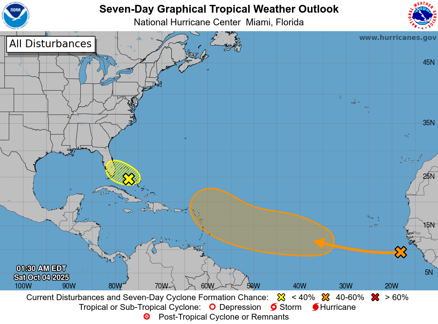
Tropical Weather Outlook — 2 AM EDT, Saturday, Oct. 4, 2025
Source: National Hurricane Center
Bahamas & Southern Florida
A weak area of low pressure near the central and northwestern Bahamas is producing disorganized showers and storms. It will drift west-northwest across the northwestern Bahamas toward southern Florida over the next couple of days. Strong upper-level winds should limit development, but the disturbance and a nearby remnant boundary will support periods of heavy rain and potential flooding across parts of Florida and the Bahamas through the weekend.
• Formation chance (48 hours): 10%
• Formation chance (7 days): 10%
Tropical Atlantic
A tropical wave near the coast of Africa is generating a broad area of showers and thunderstorms. It is expected to interact with another disturbance over the eastern tropical Atlantic, then move westward. Environmental conditions could gradually become more favorable in a few days; a tropical depression could form near or east of the Lesser Antilles by the end of next week.
• Formation chance (48 hours): Near 0%
• Formation chance (7 days): 50%
Rowan County Weather Context
No local impacts are expected from these systems through early next week. We will monitor the late-week Caribbean/Atlantic trends and the midweek cold front for any indirect pattern changes.
I’ll update again with the next NHC outlook or sooner if conditions change.