
Tropical Update – National Hurricane Center
Please take a moment to visit our local sponsors to let them know that you appreciate their support of our blog.
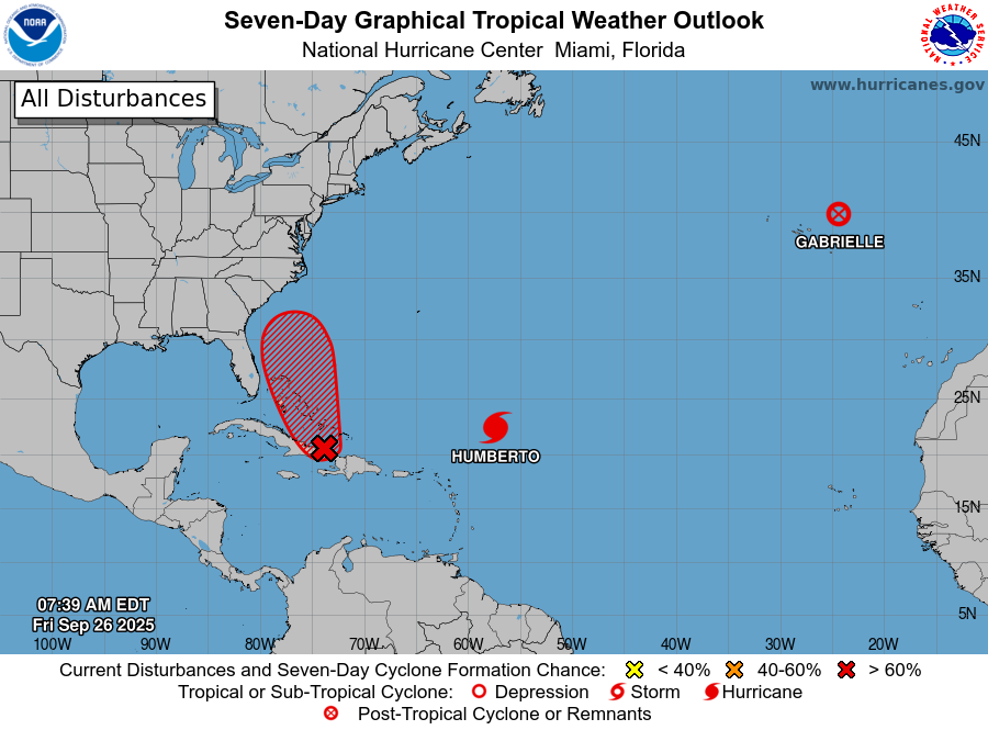
advertise your local business here »Southwestern Atlantic (AL94):
Showers and storms are becoming better organized near Hispaniola, the Turks & Caicos, and eastern Cuba. A low-pressure area is expected to form by tonight near the southeast Bahamas.
-
This system is likely to become a tropical depression over the weekend as it moves into the central and northwest Bahamas.
-
Heavy rain and gusty winds are already ongoing in the Dominican Republic, Haiti, and Turks & Caicos, and will spread into the Bahamas and eastern Cuba in the next day or two.
-
Looking ahead: While the exact track and strength are uncertain, there is a significant risk of wind, rainfall, and storm surge impacts along portions of the Southeast U.S. coast early next week.
Formation Chances (NHC):
-
Through 48 hours: 80% (High)
-
Through 7 days: 90% (High)
Rowan County Weather will continue to follow this system closely as it develops.
Source: National Hurricane Center
Please let our local sponsors know that you appreciate their support of our blog. Take a moment to visit their website linked at the top of this post.
Share this:

Announcements & Events
Check back often for important announcements and events that I'll be involved in!