
From Mild Fall Weather to a Winterlike Chill: Big Changes Coming to North Carolina This Week
Monday, November 9, 2026 | Rowan County Weather & Regional Forecasts
North Carolina is heading into a week of dramatic weather changes, with pleasant autumn afternoons giving way to a much colder pattern by Friday and the upcoming weekend.
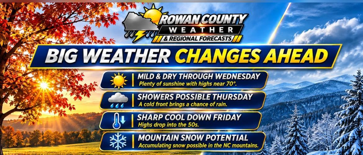
For Rowan, Davie, Davidson, and Cabarrus counties, the first half of the week will feature plenty of sunshine and temperatures near 70 degrees. However, a strong cold front approaching Thursday will bring a chance of showers, gustier winds, and some of the coldest temperatures of the season.
Meanwhile, portions of the North Carolina mountains could experience accumulating snowfall.
Sunshine and Mild Temperatures Through Wednesday
High pressure will maintain dry conditions across the region through the middle of the week.
Afternoon temperatures Monday through Wednesday should generally reach the upper 60s to lower 70s, running several degrees above seasonal averages.
Mornings will remain chilly, particularly in rural locations where temperatures can drop into the 30s. Additional patchy frost is possible before temperatures begin climbing during the afternoon hours.
Veterans Day on Wednesday is expected to feature favorable weather for outdoor ceremonies and activities, with mostly sunny skies and comfortable afternoon temperatures.
Thursday: Cold Front Brings a Chance of Showers
Our next significant weather system is expected to arrive Thursday as a strong cold front crosses the Carolinas.
The front will bring increasing cloud cover and a chance of scattered showers.
At this point, rainfall amounts appear limited across the Piedmont. The latest forecast supports approximately a 40% chance of precipitation across our four-county coverage area.
Not everyone will necessarily receive measurable rainfall.
While Thursday's rain chances deserve attention, the bigger weather story will be the much colder air arriving behind the front.
Friday and the Weekend: A Sharp Temperature Drop
By Friday, temperatures across Rowan, Davie, Davidson, and Cabarrus counties are expected to struggle into the 50s.
That represents a substantial change from the mild afternoons earlier in the week.
Northwest winds may also increase behind the front, making conditions feel even colder.
The colder air is expected to persist into the weekend, with nighttime temperatures falling into the 30s and potentially below freezing in some locations.
The greatest concern for a more widespread freeze may develop Sunday and Monday mornings as winds diminish and high pressure settles across the region.
Residents with sensitive outdoor plants should pay close attention to updated forecasts as the week progresses.
Mountain Snow Becoming More Likely
While our local Piedmont counties are expected to remain free of snow, the higher elevations of Western North Carolina could experience a different outcome.
As cold northwest winds develop behind Thursday's front, moisture moving into the mountains may produce snow showers Friday into Saturday.
The greatest potential for accumulating snow is currently along the North Carolina-Tennessee border, particularly at elevations above 3,500 feet.
Some favored mountain valleys could also see snowfall.
Exact accumulation amounts remain uncertain, and the forecast will continue to evolve as the system approaches.
For our local area, the primary impacts remain colder temperatures, gusty winds, and the potential for freezing conditions rather than winter precipitation.
What We're Watching
The Rowan County Weather forecast team will continue monitoring several important developments:
-
The timing of Thursday's cold front and associated showers.
-
How strong northwest winds become Friday and Saturday.
-
How quickly temperatures fall behind the front.
-
The potential for freezing temperatures across the Piedmont this weekend.
-
The extent of accumulating snowfall in the North Carolina mountains.
The Bottom Line
Enjoy the sunshine and mild temperatures during the first half of the week, because a significant change is approaching.
Thursday brings our next chance of showers, followed by a sharp cooldown Friday and into the weekend.
Although snow is not currently expected across Rowan, Davie, Davidson, or Cabarrus counties, freezing temperatures could become a concern as colder air settles into the Carolinas.
Rowan County Weather & Regional Forecasts will continue providing updates as new forecast guidance becomes available.