
Rain Chances Increase Tonight Across Rowan, Davie, Davidson and Cabarrus Counties
Wednesday, November 4, 2026 | Rowan County Weather & Regional Forecasts
Rain chances are increasing across the North Carolina Piedmont as a weather system approaches from the west. While the most organized rainfall remained over western North Carolina during the afternoon, some locations in our coverage area have already experienced mist, drizzle and light rain.
At the Rowan County Weather Center, periods of mist and light rain were observed throughout much of Wednesday afternoon, even though radar showed little precipitation directly overhead.
That observation highlights an important distinction: precipitation does not always have to appear clearly on radar to reach the ground.
What Radar Showed Wednesday Afternoon
Our 2:48 p.m. radar image showed a broad area of showers across western North Carolina, including the Asheville, Waynesville and Hendersonville areas.
Some of those showers were producing moderate rainfall, while the more organized precipitation remained west of Rowan, Davie, Davidson and Cabarrus counties.
As the approaching weather system draws additional moisture into the Piedmont, opportunities for measurable rainfall will increase.
However, not every location will receive rain at the same time, and rainfall amounts may vary considerably over relatively short distances.
Tonight: Rain Chances Increase, Especially After Midnight
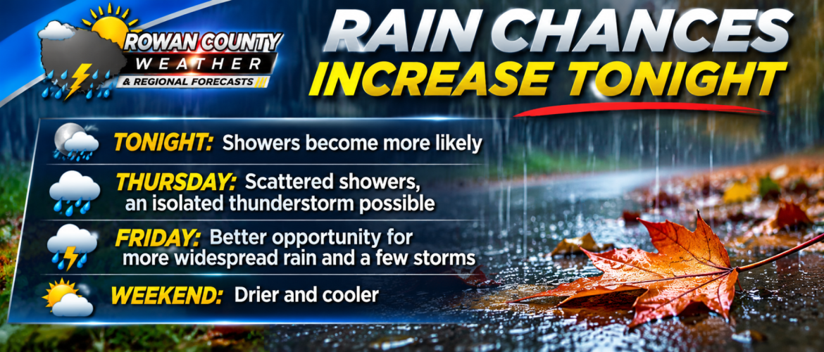
Scattered showers are expected to become more likely Wednesday evening and overnight.
The latest forecast guidance suggests the better opportunity for showers across much of the central Piedmont will develop after midnight, although some locations may experience light precipitation earlier.
Davie County and western portions of the region may have earlier opportunities for showers as precipitation approaches from the west.
Rowan and Davidson counties can expect increasing rain chances overnight, while Cabarrus County will also see opportunities for showers as moisture spreads across the region.
Rainfall amounts tonight are generally expected to remain modest. Many locations may receive less than one-quarter inch, although localized amounts could be higher.
Thursday: Scattered Showers and an Isolated Thunderstorm
Thursday will remain unusually warm and humid for early November.
Scattered showers are possible, but precipitation may be intermittent rather than continuous.
There is also enough atmospheric instability to support an isolated thunderstorm.
This means some communities may experience a passing shower while nearby locations remain dry for several hours.
Thursday is not expected to be a complete washout across all four counties.
Friday: Better Opportunity for Widespread Rain
Friday continues to offer the better opportunity for more organized rainfall as a cold front approaches and moves through the region.
Showers are expected to become more numerous, with a few thunderstorms possible.
Some thunderstorms could produce brief heavy downpours and gusty winds.
The greatest concern for stronger thunderstorms currently appears to be farther east across central and eastern North Carolina, but we will continue monitoring the potential for thunderstorms in our four-county area.
Rainfall totals will depend on the location and intensity of individual showers and thunderstorms.
While some communities could receive beneficial rainfall, others may receive considerably less.
County-by-County Outlook
Rowan County: Light rain and mist have already been observed at the Weather Center. Scattered showers become more likely tonight, with additional rain opportunities Thursday and Friday.
Davie County: Showers approaching from western North Carolina may affect the county tonight. Additional scattered showers are possible Thursday, followed by a better opportunity for organized rainfall Friday.
Davidson County: Rain chances increase overnight, particularly after midnight. Scattered showers remain possible Thursday, with more numerous showers and isolated thunderstorms possible Friday.
Cabarrus County: Scattered showers are possible tonight into Thursday. Friday offers another opportunity for rainfall and a few thunderstorms before conditions improve.
Weekend Outlook: Drier and Cooler
The approaching cold front should move through the region by the end of Friday, allowing drier air to arrive for the weekend.
Saturday and Sunday currently look considerably more favorable for outdoor activities.
Afternoon temperatures should settle back into the 60s, with chilly mornings returning. Some locations could experience overnight lows in the upper 30s.
The Bottom Line
The important message is that our region is entering a period of unsettled weather, but the rain will not necessarily arrive everywhere at once.
Mist and drizzle have already occurred in spots Wednesday afternoon. Additional showers are expected tonight, scattered rain opportunities continue Thursday, and Friday presents the better opportunity for more widespread rainfall.
Residents should remain prepared for changing conditions through Friday before a drier weekend arrives.
Rowan County Weather & Regional Forecasts will continue monitoring radar trends, rainfall timing and the potential for thunderstorms as this weather system moves across the Piedmont.