
2026–27 Long-Range Winter Forecast: What Rowan County Weather Expects This Winter
October 31, 2026 | Rowan County Weather
Will the winter of 2026–27 bring more snow to the North Carolina Piedmont? Will we see another round of significant winter weather, or will rain and milder temperatures dominate?
After examining atmospheric patterns, seasonal climate guidance, historical weather information, and the factors that influence winter weather across our region, Rowan County Weather is releasing its official 2026–27 Long-Range Winter Forecast.
This outlook focuses on Rowan, Davie, Davidson, and Cabarrus counties and covers expected temperature trends, precipitation, snowfall, and the potential for freezing rain and ice.
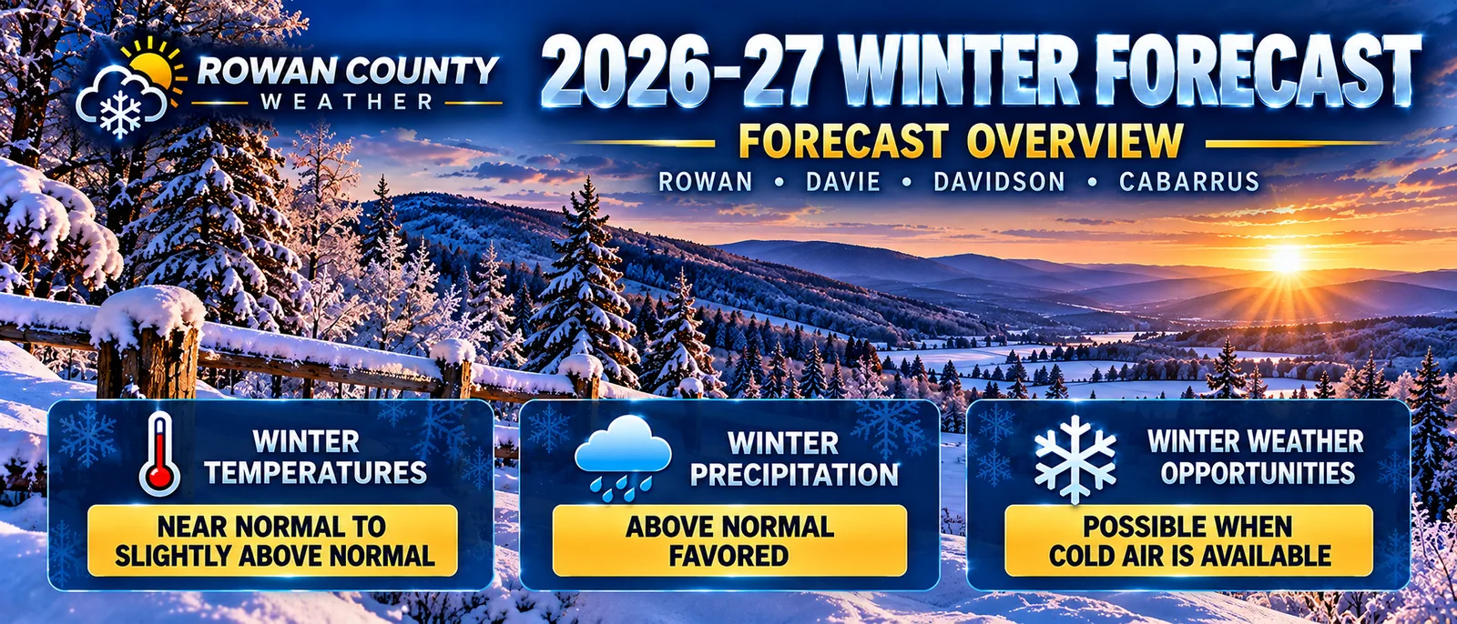
Our overall forecast favors near-normal to slightly above-normal temperatures, above-normal precipitation, and opportunities for winter weather when sufficient cold air is available.
The Big Picture: An El Niño Winter
One of the most important factors influencing the upcoming winter is El Niño.
According to NOAA's October 8, 2026, ENSO Diagnostic Discussion, an El Niño Advisory was in effect, with the Niño-3.4 index at +2.1°C. NOAA favored a strong-to-very-strong El Niño event through the January–March 2027 period.
El Niño occurs when sea-surface temperatures in the central and eastern equatorial Pacific become warmer than average. These conditions can influence atmospheric circulation and storm tracks across North America.
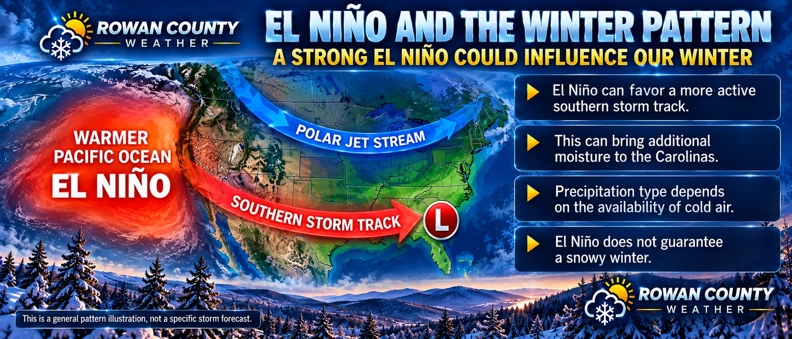
For the southern United States and the Eastern Seaboard, El Niño can favor a more active southern storm track and wetter-than-average conditions.
That is particularly important for North Carolina.
However, El Niño does not automatically guarantee a snowy winter. It changes the probabilities of certain weather patterns but does not determine the outcome of every storm.
Why the Storm Track Matters
During an El Niño winter, low-pressure systems can develop and travel across the Gulf states and Southeast, bringing moisture toward the Carolinas.
An active storm track can create additional opportunities for precipitation, but the type of precipitation depends heavily on atmospheric temperatures.
A storm arriving during mild conditions may produce rain.
A storm arriving when sufficiently cold air is established could produce snow, sleet, or freezing rain.
The precise track of each system also matters. A relatively small shift in a storm's path can produce dramatically different weather conditions across central North Carolina.
The availability and timing of cold air will be one of the biggest determining factors in how our winter unfolds.
Winter Temperature Outlook
Rowan County Weather Prediction: Near Normal to Slightly Above Normal
Our forecast calls for winter temperatures averaging near normal to slightly above normal across Rowan, Davie, Davidson, and Cabarrus counties.
NOAA's October seasonal outlook favored near-normal temperatures in parts of the Southeast, although uncertainty remains greater than in some other regions of the country.
This does not mean every week will be mild.
We can still experience significant temperature fluctuations, including periods of above-normal warmth and meaningful outbreaks of colder air.
A winter that averages near normal or slightly warmer than normal can still produce snow and ice if cold air arrives at the right time.
Seasonal temperature averages cannot tell us whether cold air will be in place when a particular storm develops.
Winter Precipitation Outlook
Rowan County Weather Prediction: Above Normal
Our precipitation forecast favors wetter-than-normal conditions.
NOAA's seasonal guidance also favors above-average precipitation across portions of the southern United States and Eastern Seaboard.
For Rowan, Davie, Davidson, and Cabarrus counties, this supports the possibility of more active storm periods throughout the winter.
However, there is an important distinction.
Above-normal precipitation does not necessarily mean above-normal snowfall.
If storms arrive when temperatures are too warm, much of that additional precipitation could fall as rain.
If colder air becomes established as storms move into the region, winter precipitation becomes more likely.
This interaction between moisture and temperature will be a central part of our winter forecast.
The 2026–27 Snowfall Forecast
Now for the question many people have been waiting to have answered.
How much snow are we predicting?
Rowan County Weather's official seasonal snowfall predictions are:
| County | Predicted Seasonal Snowfall |
|---|---|
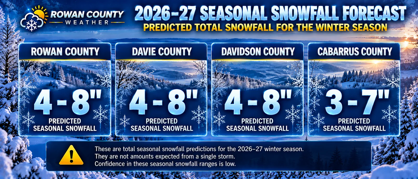
| Rowan County | 4–8 inches |
| Davie County | 4–8 inches |
| Davidson County | 4–8 inches |
| Cabarrus County | 3–7 inches |
These are our predicted total snowfall amounts for the winter season, not amounts expected from a single storm.
Confidence in these seasonal snowfall ranges is low.
While an active storm track could provide opportunities for snowfall, the amount that ultimately accumulates depends on storm timing, temperatures, and the availability of cold air.
It is also possible for one storm to account for most or even all of a season's snowfall.
These snowfall predictions are specific to Rowan County Weather and should not be confused with NOAA snowfall forecasts.
Rowan County: 4–8 Inches
For Salisbury, China Grove, Spencer, Landis, Rockwell, and surrounding communities, our seasonal snowfall prediction is 4–8 inches.
Cold-air damming, storm tracks, and precipitation type will be important factors in determining how much snow actually accumulates.
Individual events could also create travel disruptions, depending on snowfall rates, road temperatures, and whether freezing rain or sleet mixes with the snow.
Davie County: 4–8 Inches
For Mocksville, Advance, and surrounding Davie County communities, our forecast calls for 4–8 inches of seasonal snowfall.
Temperature gradients and storm tracks may create differences in precipitation type over relatively short distances.
Davidson County: 4–8 Inches
For Lexington, Thomasville, Denton, and surrounding communities, our seasonal snowfall prediction is also 4–8 inches.
As with neighboring counties, relatively small temperature differences could influence whether a storm produces rain, snow, or a mixture of precipitation types.
Cabarrus County: 3–7 Inches
For Concord, Kannapolis, Harrisburg, Mount Pleasant, and surrounding communities, our seasonal snowfall prediction is 3–7 inches.
Cabarrus County may experience situations where small changes in the freezing line determine whether precipitation falls primarily as rain or includes snow, sleet, or freezing rain.
Local variations are possible across all four counties.
Putting the Snowfall Forecast in Perspective
Snowfall across the North Carolina Piedmont varies considerably from one winter to another.
For historical context, the 1991–2020 average annual snowfall is approximately 3.3 inches for Concord and approximately 5 inches for Mocksville.
We also experienced a reminder of how variable snowfall can be during February 2026, when portions of our coverage area received locally more than a foot of snow.
A single significant storm can exceed what an area typically receives during an entire winter.
These historical observations provide context for our predictions, but they do not guarantee that similar events will occur this season.
What About Ice and Freezing Rain?
Rowan County Weather Prediction: Meaningful Freezing-Rain Potential
Snow is not the only winter-weather concern for our region.
Freezing rain and ice can become significant hazards across the North Carolina Piedmont, particularly during cold-air damming events.
Cold-air damming occurs when shallow cold air becomes trapped near the surface east of the Appalachian Mountains.
If warmer, moisture-rich air moves over that cold layer, precipitation may fall as freezing rain.
This can produce hazardous conditions on roads, bridges, trees, and power lines.
Our winter outlook recognizes meaningful freezing-rain potential, but we are not predicting a specific number of ice storms or issuing a warning for any particular event.
Actual ice risks will depend on the atmospheric conditions and storm tracks present when individual weather systems approach.
The Biggest Wildcard: Cold Air
One of the most important questions this winter will be whether sufficient cold air can reach our region at the same time as incoming moisture.
Several atmospheric factors could influence that outcome, including:
-
The strength and position of the polar jet stream.
-
The delivery of Arctic air into the eastern United States.
-
Atmospheric blocking patterns.
-
The frequency of cold-air damming events.
-
Storm tracks, timing, and surface temperatures.
A southern-track storm may provide abundant moisture, but without sufficiently cold temperatures, precipitation could remain rain.
An inland or warmer storm track may also favor rain.
A coastal storm occurring with established cold air could create a more favorable environment for winter precipitation.
These details become much clearer as individual storms approach.
How Confident Are We in This Forecast?
Not every part of a long-range forecast carries the same level of confidence.
Higher confidence: El Niño's influence on the larger atmospheric pattern and the wetter signal across the southern and eastern United States.
Moderate confidence: The broad regional precipitation outlook, including our expectation for above-normal precipitation.
Lower confidence: Seasonal snowfall amounts, the timing of individual winter storms, and the occurrence and severity of specific snow or ice events.
Long-range forecasting is about identifying the patterns and probabilities that may shape an entire season.
It is not a reliable method for predicting the exact date of a snowstorm months in advance.
As winter approaches and shorter-range guidance becomes available, our confidence in individual weather events will improve.
Preparing for the Winter Ahead
Even during winters that average near normal or slightly warmer than normal, occasional winter-weather disruptions remain possible.
Residents should prepare for cold rain, freezing temperatures, and the possibility of snow or ice affecting travel.
Maintain multiple ways to receive National Weather Service watches and warnings, and pay attention to daily forecasts when winter-weather systems approach.
When freezing rain or accumulating snow is expected, avoid unnecessary travel during hazardous conditions.
Rowan County Weather will continue monitoring the atmosphere and providing updates throughout the winter season.
Our Official 2026–27 Winter Forecast: Final Summary
Here is our complete seasonal outlook for Rowan, Davie, Davidson, and Cabarrus counties.
| Forecast Category | Rowan County Weather Prediction |
|---|---|
| Winter Temperatures | Near normal to slightly above normal |
| Winter Precipitation | Above normal favored |
| Rowan County Snowfall | 4–8 inches |
| Davie County Snowfall | 4–8 inches |
| Davidson County Snowfall | 4–8 inches |
| Cabarrus County Snowfall | 3–7 inches |
| Freezing Rain and Ice | Meaningful potential; no specific storm count predicted |
The bottom line is that a strong El Niño increases our interest in the southern storm track, and wetter-than-normal conditions are favored across the broader region.
For central North Carolina, that could provide opportunities for winter precipitation.
But whether that moisture falls as rain, snow, sleet, or freezing rain will depend on the timing and availability of cold air.
That remains the most important uncertainty heading into the 2026–27 winter season.
Rowan County Weather will continue following the evolving atmospheric patterns and providing forecasts for Rowan, Davie, Davidson, and Cabarrus counties throughout the winter.
Your Weather. Your Community.
Forecast Sources and Methodology
This outlook incorporates seasonal climate guidance and historical weather information, including:
-
NOAA Climate Prediction Center — ENSO Diagnostic Discussion, October 8, 2026.
-
NOAA U.S. Winter Outlook, October 15, 2026.
-
NOAA Climate Prediction Center — Long-Lead Seasonal Outlook Discussion, October 15, 2026.
-
Historical snowfall information from NOAA/NCEI climate normals, the North Carolina State Climate Office, and Current Results.
The seasonal temperature, precipitation, snowfall, and ice predictions presented in this article represent the Rowan County Weather outlook. Seasonal predictions are subject to uncertainty and should not be interpreted as forecasts of individual winter storms.