
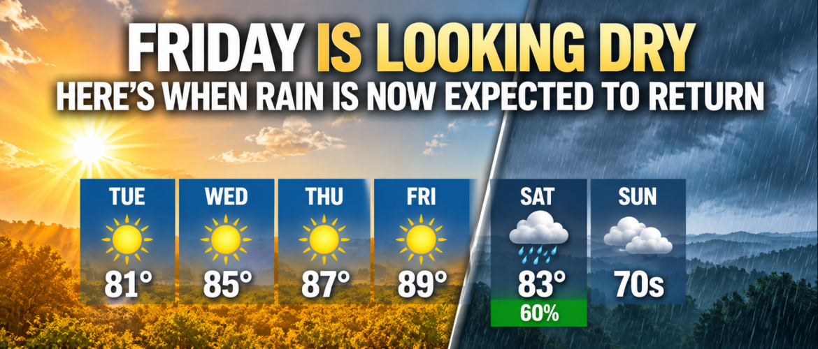
Friday Is Looking Dry — Here’s When Rain Is Now Expected to Return
Anyone making plans for the end of the workweek is getting some good news from the latest forecast trends. The arrival of our next round of rain continues to slow, and confidence is increasing that Friday will remain dry across Rowan, Davie, Davidson and Cabarrus counties.
That gives us several more days of sunshine and increasingly warm temperatures before the pattern changes this weekend.
Sunshine and Warming Through Friday
Tuesday will feature plenty of sunshine across the region, with afternoon temperatures generally in the lower 80s.
The warming trend picks up from there.
Wednesday brings highs in the mid-80s, followed by upper 80s Thursday. Friday currently looks like the warmest day of the week, with highs reaching the upper 80s and some locations approaching 90 degrees.
For Rowan County, I'm forecasting a high around 89 degrees Friday. Davie County should reach around 88, Davidson County around 89 and Cabarrus County around 88.
Despite increasing moisture ahead of the approaching weather system, Friday continues to look dry across the region.
Rain Timing Keeps Getting Slower
This is one of the more important changes I've been watching.
Earlier forecasts left more uncertainty about whether showers could begin affecting the region before the end of the workweek. The latest guidance has continued shifting the meaningful rain chances later.
Around 75% of the latest long-range ensemble members keep rain away until at least Friday night, while the major global forecast models hold the rain off until early Saturday.
That doesn't mean the timing is completely settled. There is always some uncertainty several days in advance, particularly regarding exactly when moisture becomes deep enough to produce rain.
But confidence is growing that Friday should remain dry for most, if not all, of our region.
Saturday Becomes the Transition Day
Saturday is when things begin changing.
The morning and at least part of the early day may remain dry, but clouds should increase as moisture builds across the Carolinas.
Showers are expected to become increasingly likely during the afternoon.
I'm currently carrying a 60% chance of rain Saturday across Rowan, Davie, Davidson and Cabarrus counties, with highs generally in the lower 80s.
Showers should continue into Saturday night.
There could also be a few thunderstorms, particularly around Davidson County and areas farther east, although the amount of instability available for thunderstorms currently appears limited.
It's Not Just Rain — Cooler Air Is Coming
The return of rain is only part of the weekend story.
A cold-air damming pattern, commonly called a "wedge," is expected to begin developing across portions of the Carolinas.
Cooler air near the surface combined with increasing clouds and rain should put an end to the late-week warmth.
After temperatures approach 90 degrees Friday, highs are expected to fall into the 70s by Sunday across much of the region.
There remains some uncertainty regarding exactly how quickly the wedge develops and how strong it becomes, particularly across Davidson County. But the overall signal for a cooler and cloudier end to the weekend is becoming increasingly consistent.
Another Cooldown May Follow
The weekend wedge may only be the beginning.
A stronger cold front is expected to move through the region around Monday. Behind it, a cooler Canadian air mass should spread across the eastern United States.
That could set us up for some of the coolest temperatures we've experienced so far this fall during the early part of next week.
There is still plenty of time for the details of that portion of the forecast to change, so I'll continue watching the trends over the next several days.
For now, the message is becoming clearer: Friday is looking increasingly favorable for outdoor plans. Saturday is the transition day, with rain returning during the afternoon, followed by a much cooler pattern Sunday and into early next week.