
Tropical Depression Edouard Moves Inland as Significant Flash Flooding Threat Continues in Texas
Tropical Depression Edouard continues to weaken after moving inland, but the system remains a significant rainfall and flooding threat across portions of Texas.
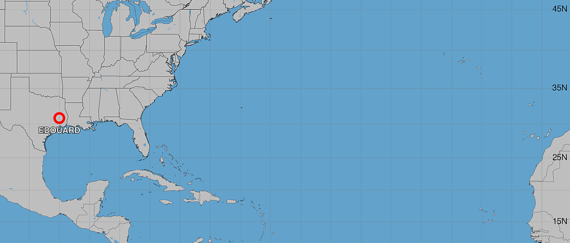
As of 4:00 AM CDT Wednesday, September 2, Edouard was centered near 30.8°N, 95.0°W with maximum sustained winds of 35 mph. The depression is expected to continue moving slowly north-northwest across eastern Texas today before weakening into a remnant low Thursday.
While Edouard's winds will gradually decrease, heavy rainfall remains the primary concern.
Edouard Continues to Weaken Inland
Edouard is forecast to weaken steadily as its circulation moves farther inland.
The forecast calls for maximum sustained winds to decrease to around 30 mph later Wednesday as the center moves across eastern Texas. By early Thursday, Edouard is expected to become a post-tropical or remnant low with winds around 25 mph.
The system is forecast to dissipate later Thursday.
Despite that weakening trend, wind gusts to tropical-storm force remain possible near the center of Edouard for the next several hours.
Heavy Rain and Flash Flooding Are the Biggest Concerns
The most significant threat from Edouard is now heavy rainfall.
As the depression slowly moves north-northwest, bands of heavy rain will gradually pull north of the Upper Texas coast and southwestern Louisiana Wednesday morning.
Those bands will then continue tracking across east-central Texas through Thursday morning.
The slow movement of the system increases the potential for heavy rainfall to repeatedly affect some of the same locations.
Flash flooding is likely across portions of the region, particularly in urban areas where heavy rainfall can overwhelm drainage systems more quickly.
Significant flash flooding is possible in some locations.
River flooding may also become a concern as runoff from the heavy rainfall works into area creeks, streams and rivers.
Forecast Track
The latest forecast positions for Edouard show the system remaining over Texas as it weakens:
Wednesday morning: 35 mph tropical depression near 30.8°N, 95.0°W.
Wednesday afternoon: 30 mph tropical depression near 31.4°N, 95.5°W and well inland.
Early Thursday: 25 mph post-tropical/remnant low near 32.4°N, 96.1°W.
Thursday afternoon: Edouard is expected to dissipate.
With the center already inland, additional strengthening is not expected.
Wind Is Becoming Secondary to the Flood Threat
Edouard's classification as a tropical depression should not be used as an indication that the threat has ended.
Tropical systems can continue producing dangerous flooding well after moving inland and weakening below tropical-storm strength.
In Edouard's case, the combination of tropical moisture and slow movement means heavy rainfall will remain capable of producing flash flooding even as maximum sustained winds continue decreasing.
For communities across east-central Texas, flooding will be the primary concern through Wednesday and into Thursday morning.
What Happens Next?
Edouard should continue moving north-northwest through eastern Texas today while gradually weakening.
By early Thursday, the system is forecast to lose its tropical characteristics and become a remnant low. Complete dissipation is expected later Thursday.
The tropical cyclone itself may be nearing the end of its life cycle, but flooding impacts can continue beyond dissipation as water moves downstream through rivers and drainage systems.
Residents in affected areas should continue monitoring local warnings and avoid flooded roads. Never attempt to drive through water covering a roadway.
Key Takeaways
Tropical Depression Edouard is inland and weakening, with maximum sustained winds around 35 mph early Wednesday.
Tropical-storm-force wind gusts remain possible near the center for the next several hours.
Heavy rainfall is now the primary threat as Edouard moves slowly across eastern Texas.
Flash flooding is likely, particularly in urban areas, and significant flash flooding is possible.
River flooding may also occur.
Edouard is expected to become a remnant low early Thursday and dissipate later Thursday.
Rowan County Weather and Regional Forecast will continue monitoring Edouard as the system moves farther inland and eventually dissipates.