
What Is an MCS? Why This Type of Storm System Could Matter for Rowan County Tuesday
If you have been following the forecast for Tuesday, you may have seen the term MCS mentioned when discussing the possibility of stronger thunderstorms across the region.
It is a term meteorologists frequently use during the warmer months, but what exactly is an MCS, and why does it matter for Rowan County?
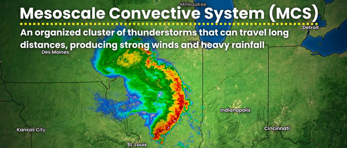
An MCS, or Mesoscale Convective System, is essentially a large, organized collection of thunderstorms that begins behaving as one weather system rather than a group of individual storms.
And one of these systems could play an important role in our weather Tuesday.
More Than an Ordinary Afternoon Thunderstorm
Summer thunderstorms across North Carolina frequently develop because of daytime heating.
The sun heats the ground, temperatures rise, instability increases and scattered thunderstorms begin developing during the afternoon.
Many of those storms are relatively small and short-lived.
An MCS is different.
Individual thunderstorms can merge and organize into a much larger complex that may cover hundreds of miles and survive for many hours.
Some MCSs develop during the afternoon and continue well into the night. Others can travel across several states before finally weakening.
That ability to remain organized is one reason they can produce more widespread impacts than an isolated summertime thunderstorm.
Damaging Winds Can Be the Biggest Concern
One of the primary hazards associated with a strong MCS is straight-line wind.
As thunderstorms develop, rain-cooled air descends toward the surface. When numerous thunderstorms become organized, those downdrafts can combine and produce a large area of powerful outflow winds.
In stronger systems, damaging winds can extend across a considerable distance.
Trees and power lines can be brought down, and unsecured outdoor objects can be blown around.
This is one reason damaging wind is the primary severe-weather concern with Tuesday's setup.
Rowan County is currently included in a Marginal Risk for severe thunderstorms Tuesday, with a 5% probability of damaging thunderstorm winds occurring within 25 miles of a given point.
That does not mean damaging winds will occur across 5% of Rowan County, nor does it mean there is simply a 5% chance of thunderstorms.
It represents the probability of damaging winds occurring within 25 miles of a location within the outlined area.
Why Tuesday's Setup Has My Attention
The atmosphere Tuesday will be hot and humid.
Rowan County is forecast to reach around 95 degrees, with heat index values potentially reaching approximately 103 degrees.
That heat and humidity can provide substantial instability for thunderstorms.
Meanwhile, the larger weather pattern could allow an organized thunderstorm complex to develop upstream and move generally southeast toward the Appalachians and Piedmont.
The important word there is could.
There is still considerable uncertainty about exactly where an MCS may develop and, more importantly for us, where it would travel afterward.
Some indications favor a track farther north through Virginia and northern North Carolina. A farther-south track or an outflow boundary moving south from the main complex could bring stronger thunderstorms closer to Rowan County.
Those relatively small differences in track can produce dramatically different outcomes locally.
Why MCS Forecasting Can Be Difficult
An MCS is one of those weather features where the forecast can change considerably in a relatively short period.
Where thunderstorms initially develop matters.
How quickly they organize matters.
The strength and direction of winds at different levels of the atmosphere matter.
Even thunderstorms that develop earlier in the day hundreds of miles away can change the environment and influence where the next round develops.
An MCS can also produce its own pool of rain-cooled air. The leading edge of that cooler air is known as an outflow boundary.
Think of it somewhat like a miniature cold front produced by thunderstorms.
That boundary can travel well away from the original storms and sometimes trigger additional thunderstorms when it encounters hot, unstable air.
This is one reason forecasting the exact location of Tuesday evening's thunderstorms remains challenging.
An MCS Doesn't Have to Pass Directly Over Us to Affect Us
This is another important part of Tuesday's forecast.
Suppose the primary thunderstorm complex passes north of Rowan County.
That doesn't necessarily mean nothing happens here.
An outflow boundary from storms farther north could push southward into the Piedmont and trigger new thunderstorms.
Cloud debris from an upstream thunderstorm complex could also affect temperatures and instability.
On the other hand, if widespread clouds arrive earlier than anticipated, they could reduce daytime heating and make the atmosphere less favorable for severe thunderstorms.
One system hundreds of miles away can therefore have a significant influence on what eventually happens locally.
What I'll Be Watching Tuesday
Several pieces will become increasingly important as we move through Tuesday.
Where thunderstorms initially develop will be the first clue. From there, I'll be watching whether those storms remain isolated or quickly begin organizing into a larger complex.
The direction and speed of that complex will then become critical for Rowan County.
I'll also be watching for outflow boundaries moving away from the main thunderstorms. Those boundaries may ultimately determine whether additional storms develop farther south.
Finally, temperatures and cloud cover will tell us how much instability is available when any storms approach.
These are details that become much easier to evaluate once thunderstorms actually begin developing.
What This Means for Rowan County
The takeaway this afternoon isn't that an MCS is definitely coming to Rowan County Tuesday.
It isn't.
Instead, the atmospheric pattern provides an opportunity for more organized thunderstorms than the typical isolated storms we frequently experience on summer afternoons.
If an organized system or its associated outflow reaches Rowan County while the atmosphere remains sufficiently unstable, stronger thunderstorms capable of damaging wind gusts could develop.
If the primary system tracks farther north, our impacts could be considerably more limited.
That uncertainty is exactly why Tuesday is worth watching without sounding the alarm.
As of Monday afternoon, Rowan County remains under a Marginal Risk for severe thunderstorms Tuesday, with damaging winds the primary concern.
I'll continue monitoring the latest short-range guidance tonight and Tuesday morning as we get a clearer picture of where any organized thunderstorm complex may develop and where it may ultimately track.