

Strong to Severe Thunderstorms Possible This Afternoon Across Rowan County
A cold front will move through the Carolinas later today, bringing the potential for strong to severe thunderstorms across Rowan County during the afternoon and evening hours. While not everyone will experience a storm, those that do could see hazardous weather in a short amount of time.
The greatest threat window appears to be between 2 PM and 8 PM, with storms moving from northwest to southeast as the cold front approaches.
Rowan County Remains in a Slight Risk
The Storm Prediction Center continues to place Rowan County under a Slight Risk (Level 2 of 5) for severe thunderstorms today. A Slight Risk means scattered severe storms are possible, and some could become intense.
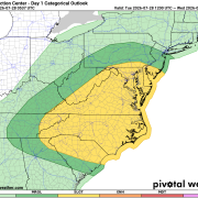
Primary Threat: Damaging Winds
The biggest concern today will be damaging straight-line winds capable of bringing down trees and power lines while causing scattered power outages.
The latest Storm Prediction Center outlook places Rowan County within the 30% damaging wind probability area, highlighting a heightened risk for severe wind-producing thunderstorms this afternoon and evening. Any storm that becomes severe could produce wind gusts in excess of 60 mph, making damaging winds the primary hazard to monitor today.
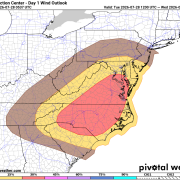
Secondary Threat: Large Hail
Today's atmosphere will also support the development of large hail, especially with any stronger individual thunderstorms that can remain organized.
Rowan County is included within the 5% hail probability area, meaning isolated storms may be capable of producing severe hail.
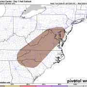
Tornado Risk Remains Low, But Not Zero
Although tornadoes are not expected to be the primary hazard, the environment could support an isolated tornado if storms remain discrete before merging into clusters.
Rowan County lies within the 2% tornado probability area, meaning the risk is low, but residents should still have multiple ways to receive warnings should a Tornado Warning be issued.
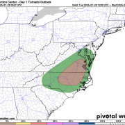
Timing
- Morning: Mainly dry with increasing clouds.
- Early Afternoon (2–4 PM): Isolated storms begin developing.
- Late Afternoon into Early Evening (4–8 PM): Highest chance for strong to severe thunderstorms.
- After Sunset: Storms quickly move southeast with improving conditions overnight.
What to Expect After the Front
The good news is today's storms will usher in a much more comfortable air mass.
From Wednesday through Friday, expect:
- Plenty of sunshine
- Highs in the mid to upper 80s
- Much lower humidity
- Overnight lows in the lower 60s
It will be one of the nicest stretches of weather we've experienced in several weeks before rain chances gradually return this weekend.
Stay Weather Aware
Because storms may develop quickly this afternoon, now is a good time to review your severe weather plan. Make sure you have multiple ways to receive warnings, especially if you'll be outdoors later today. Even though many communities may never see a storm, the ones that do could experience damaging winds, large hail, frequent lightning, and torrential rainfall.