Tropical Storm Bertha Continues to Weaken, But Flooding Threat Persists Along the Gulf Coast
Tropical Storm Bertha continues to weaken this morning as increasing wind shear and interaction with land take a toll on the storm's structure. The National Hurricane Center notes that Bertha's strongest thunderstorms have become displaced well south of its center, leaving much of the low-level circulation exposed near the Alabama coast.
An Air Force Reserve Hurricane Hunter aircraft found maximum flight-level winds of 47 knots and a minimum central pressure of 998 mb during its final reconnaissance mission overnight. Based on those observations, Bertha's maximum sustained winds have been lowered to 45 knots (50 mph), although forecasters note the storm could be even weaker than current estimates suggest.
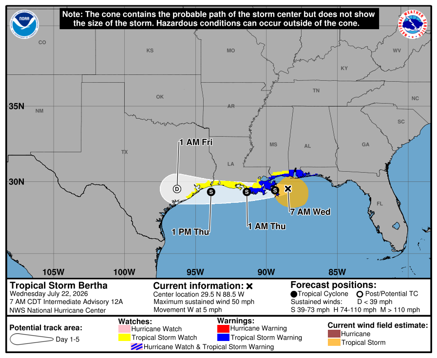
Bertha is moving slowly west at around 4 mph, steered by a ridge of high pressure positioned to its north. That westward motion is expected to continue through the next day or so. However, forecasters are closely monitoring the possibility that persistent bursts of thunderstorms south of the current center could attempt to form a new circulation. While some forecast models suggest this may occur, the National Hurricane Center is not currently forecasting a center reformation.
Over the next 24 hours, Bertha is expected to gradually weaken as it continues to battle 25 to 30 knots of northeasterly wind shear while remaining close to the Gulf Coast. Beyond that, the forecast becomes more uncertain. If the existing circulation remains near the coastline, the system could weaken into an open trough. If a new center develops farther south over the Gulf, limited reorganization could occur before the system eventually moves inland.
The official forecast continues to call for slow weakening before Bertha moves inland across Texas within the next two days. The system is expected to become post-tropical before dissipating shortly thereafter.
Although Bertha is weakening, hazardous weather continues along portions of the northern Gulf Coast. Tropical storm conditions are expected from the western Florida Panhandle westward into southeastern Louisiana, including the New Orleans metropolitan area, through tonight. Tropical storm conditions may also spread into portions of southwestern Louisiana tonight and Thursday.
A Coastal Flood Warning remains in effect along portions of the Mississippi and Louisiana coastlines, where moderate coastal flooding is expected. Residents in western Louisiana and along the upper Texas coast should continue monitoring the system, as additional watches or warnings may become necessary.
Heavy rainfall also remains a concern. Isolated flash flooding is possible through early Friday across portions of the central and western Gulf Coast, extending from western Florida westward to southern Texas.
Bertha is not expected to have any direct impacts on North Carolina. However, Rowan County Weather will continue to monitor the storm and provide updates on any significant changes to the forecast.