Tropical Disturbance in the Gulf Being Monitored; No Immediate Threat to North Carolina
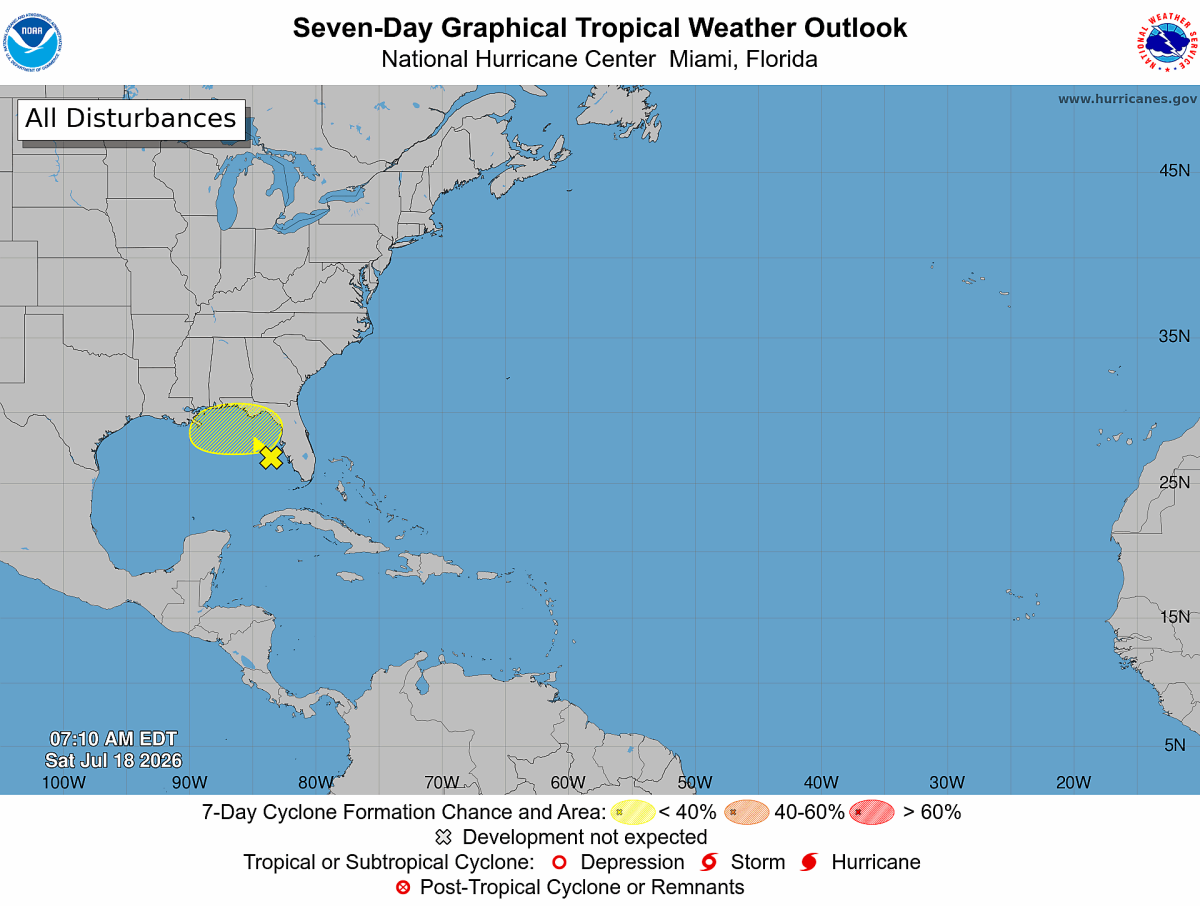
The National Hurricane Center is monitoring an area of disturbed weather over the eastern Gulf that has a low chance of tropical development over the next several days.
The system consists of showers and thunderstorms associated with an upper-level low and a surface trough over the eastern Gulf. At this time, surface pressures remain relatively high and winds are light, indicating that the disturbance is not well organized.
Forecasters say gradual development is possible as the system drifts slowly northward or north-northwestward over the next few days.
The greatest concern in the short term is expected to be heavy rainfall along portions of Florida's west coast and the Florida Panhandle. Residents and visitors in those areas should continue to monitor the latest forecasts as periods of heavy rain could lead to localized flooding.
Development Chances
- Next 48 hours: 20% (Low)
- Next 7 days: 30% (Low)
Any Impact on North Carolina?
At this time, there is no indication of a direct impact on North Carolina from this system. Forecast guidance keeps the disturbance focused near the eastern Gulf and Florida through the next several days.
As always during hurricane season, forecast confidence decreases farther into the future, and Rowan County Weather will continue to monitor the system for any significant changes.
There are currently no tropical storms or hurricanes affecting the Atlantic Basin, but the climatological peak of hurricane season is still several weeks away, making this the time of year when tropical activity typically begins to increase.
Rowan County Weather will continue providing updates if the disturbance becomes better organized or if its forecast changes.