

Severe Weather Threat Returns Today Across Rowan, Davie, and Davidson Counties
After several days of active weather, the threat for strong to severe thunderstorms continues across the western Carolinas today. The Storm Prediction Center has placed Rowan, Davie, and Davidson counties in a Level 2 of 5 (Slight Risk) for severe weather, with the greatest concern developing from mid-afternoon through this evening.
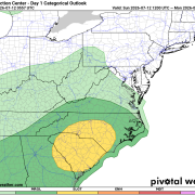
Today's setup is a bit more favorable for organized storms than what we've seen over the past couple of days. A backdoor cold front will slide into the area while an upper-level disturbance approaches from the Tennessee Valley. At the same time, increasing winds aloft will provide better wind shear, allowing storms to organize more efficiently.
Primary Threats
Damaging Wind Gusts
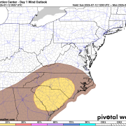
The main severe weather hazard today will be damaging straight-line winds. The Storm Prediction Center highlights our area with a 15% probability of damaging winds within 25 miles of any location, with storms capable of producing wind gusts over 60 mph. Those winds could bring down tree limbs, cause isolated power outages, and create hazardous travel conditions.
Localized Flash Flooding
Heavy rainfall is an equally significant concern. The atmosphere remains extremely moisture-rich, with tropical-level moisture in place. Slow-moving storms and repeated rounds of rainfall could quickly overwhelm drainage systems, especially in locations that have already received heavy rain over the past several days.
Rainfall totals of 1 to 2 inches will be common in some areas, with locally higher amounts where storms repeatedly move over the same location. Flash flooding of low-lying and poor drainage areas will be possible.
Frequent Lightning
Every thunderstorm will be capable of producing dangerous cloud-to-ground lightning. If thunder roars, head indoors immediately.
Timing
- Morning: Mainly dry with increasing clouds.
- 2 PM – 5 PM: Storms begin developing across the region.
- 5 PM – 10 PM: Highest likelihood of strong to severe thunderstorms.
- Overnight: Showers and thunderstorms continue, with heavy rain remaining possible into early Monday.
Monday Remains Wet
The active pattern doesn't end tonight. Showers and thunderstorms remain likely throughout Monday as cooler northeast winds settle into the region. While the severe weather threat should diminish, periods of heavy rain could continue, keeping the risk for localized flooding in place.
Temperatures Monday will be a welcome change after recent heat, with highs only reaching the mid-70s across much of the area.
Looking Ahead
Rain chances gradually decrease Tuesday before sunshine returns Wednesday. Temperatures will quickly rebound into the upper 80s Wednesday and the lower 90s Thursday as a more typical summertime pattern returns.
Bottom Line
Today's weather deserves your attention.
- Slight Risk (Level 2 of 5) for severe thunderstorms across Rowan, Davie, and Davidson counties.
- Damaging wind gusts are the primary severe weather threat.
- Localized flash flooding is possible due to repeated heavy rainfall.
- Frequent lightning will accompany any thunderstorm.
- Keep weather alerts enabled and have multiple ways to receive warnings this afternoon and evening.
I'll be monitoring conditions throughout the day and will provide radar updates and any watches or warnings that are issued for our area.