

Strong Thunderstorm Moving Across Rowan County Through 4:00 PM
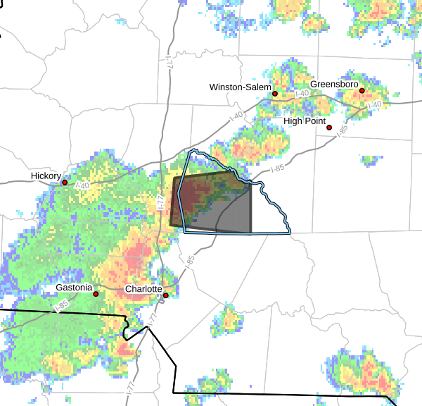
A strong thunderstorm is moving across Rowan County this afternoon and will continue impacting portions of the county through 4:00 PM EDT.
At 3:22 PM, Doppler radar indicated a strong thunderstorm located approximately 12 miles northwest of Kannapolis, or about 5 miles south of Cleveland, moving east at 15 mph.
While this storm is not currently severe warned, it is capable of producing:
- Wind gusts up to 40 mph
- Pea-size hail
- Frequent lightning
- Heavy rainfall
Wind gusts may be strong enough to knock down small tree limbs and blow around unsecured outdoor objects. Minor hail damage to vehicles, patio furniture, and other outdoor items is also possible.
Communities that could be impacted include:
- Salisbury
- Kannapolis
- China Grove
- Spencer
- Landis
- Granite Quarry
- Rockwell
- Cleveland
- Faith
- Mooresville
If you are outdoors, move inside a sturdy building until the storm passes. Remember that lightning can strike well away from the heaviest rain, so do not wait until the storm is directly overhead before seeking shelter.
I will continue to monitor this storm and provide updates if it strengthens or if any additional warnings are issued for Rowan County.