Davidson County Forecast: Summer Heat Continues Before a Cooler Finish to the Weekend
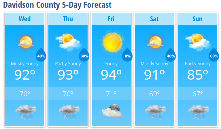
Summer weather isn't going anywhere just yet. Davidson County will remain hot through Saturday with afternoon highs in the lower to middle 90s and daily opportunities for scattered showers and thunderstorms. A cold front arriving late this weekend will increase rain chances and bring cooler, less humid air by Sunday.
Wednesday
Expect another warm summer day with plenty of sunshine.
- High: 92°
- Mostly sunny
- Calm wind
Wednesday Night
Scattered thunderstorms may develop during the evening before gradually ending.
- Low: 70°
- 40% chance of showers and thunderstorms before 10 PM
Thursday
Another hot afternoon with only isolated storm chances.
- Partly sunny
- High: 93°
- 30% chance of showers and thunderstorms after 2 PM
- West wind 5 to 7 mph during the afternoon
Friday
The hottest day of the forecast.
- Sunny
- High: 94°
- Partly cloudy Friday night with a low of 71°
Saturday
Storm chances begin increasing ahead of an approaching cold front.
- Mostly sunny
- High: 91°
- 40% chance of afternoon and evening showers and thunderstorms
Sunday
A noticeable change arrives to end the weekend.
- Partly sunny
- High: 85°
- 60% chance of showers and thunderstorms
Additional showers and thunderstorms remain likely Sunday night as the front moves through.
What I'm Watching
Hot and Humid Through Saturday
Temperatures will remain above normal through Saturday, with heat index values climbing into the upper 90s and lower 100s during the afternoon.
✔ Stay hydrated.
✔ Take frequent breaks if spending time outdoors.
✔ Never leave children or pets inside parked vehicles.
Daily Storm Chances Continue
Scattered thunderstorms remain possible each afternoon and evening through the end of the workweek.
Any stronger storm could produce:
- Damaging wind gusts
- Frequent lightning
- Brief heavy rainfall
Storm coverage will become more widespread this weekend as a cold front moves into the region.
Cooler Air Returns Sunday
Sunday currently looks to be the coolest day of the forecast, with highs dropping into the mid-80s as cooler and less humid air begins filtering into the area. That more comfortable weather is expected to continue into early next week.
Davidson County Weather Summary
- Warm and humid weather continues through Saturday.
- Highs remain in the lower to middle 90s through the end of the week.
- Daily afternoon and evening storm chances continue, with coverage increasing this weekend.
- Sunday currently has the highest rain chance at 60%.
- Cooler, less humid weather arrives Sunday and continues into early next week.