Davidson County Forecast: Dangerous Heat Continues Through the Fourth of July Weekend
Dangerous heat will remain the biggest weather story across Davidson County through the Independence Day holiday weekend. Afternoon temperatures will climb into the upper 90s and lower 100s, with heat index values reaching 105 degrees during the hottest part of the day.
A Heat Advisory is in effect today from Noon until 8:00 PM as dangerous heat and humidity combine to create hazardous conditions for anyone spending time outdoors.
Today's Forecast
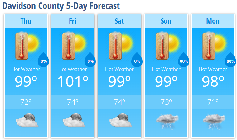
Thursday: Sunny and dangerously hot with a high near 99°. Heat index values could reach 105° this afternoon. Winds remain light and variable.
Tonight: Mostly clear with a warm low around 72°.
Fourth of July Weekend
The heat wave continues through the holiday weekend with little relief expected.
Friday: Sunny and hot with a high near 101°. Heat index values up to 105°.
Friday Night: Mostly clear with a low around 74°.
Independence Day (Saturday): Sunny and hot with a high near 99°. It will be a great day for fireworks and holiday celebrations, but the afternoon heat will be dangerous. If you're spending time outside, be sure to stay hydrated and take frequent breaks in the shade or air conditioning.
Saturday Night: Mostly clear with a low around 74°.
Sunday: Mostly sunny and hot with a high near 99°.
Sunday Night: A 30% chance of showers and thunderstorms between 8 PM and 2 AM. Partly cloudy with a low around 73°.
Early Next Week
The weather pattern begins to transition back toward a more typical summertime pattern.
Monday: Mostly sunny and hot with a high near 98°. Showers and thunderstorms become likely after 2 PM with a 60% chance of rain.
Monday Night: Showers and thunderstorms remain likely, mainly before 8 PM. Mostly cloudy with a low around 71°.
Heat Safety
The biggest concern isn't just one hot day—it's several consecutive days of dangerous heat with very warm nights that offer little relief.
- Drink plenty of water throughout the day.
- Avoid strenuous outdoor activities during the afternoon.
- Take frequent breaks in air-conditioned buildings or shaded areas.
- Never leave children or pets inside parked vehicles.
Storm Chances
Most of the holiday weekend should remain dry across Davidson County, although an isolated thunderstorm cannot be ruled out. Better chances for showers and thunderstorms arrive Sunday night and especially Monday as the heat ridge begins to weaken and a more typical summertime weather pattern returns.
Looking Ahead
While temperatures will remain hot through the weekend, relief is on the horizon. Beginning early next week, afternoon highs should gradually ease back into the 90s as daily thunderstorm chances increase, bringing a more seasonable summer weather pattern to Davidson County.