Davidson County Forecast: Dangerous Heat Continues Through the Holiday Weekend
Dangerous summer heat will continue to build across Davidson County through the Fourth of July holiday weekend before a more typical summertime weather pattern returns early next week.
Afternoon temperatures will climb into the upper 90s through Saturday, with heat index values reaching 100 to 101 degrees during the hottest part of the day. While Heat Advisories are not currently expected, several consecutive days of intense heat can still create dangerous conditions for anyone spending extended time outdoors.
The good news is that relief is on the way. Beginning Sunday, scattered afternoon and evening thunderstorms return, bringing temperatures closer to seasonal averages for early July.
Forecast
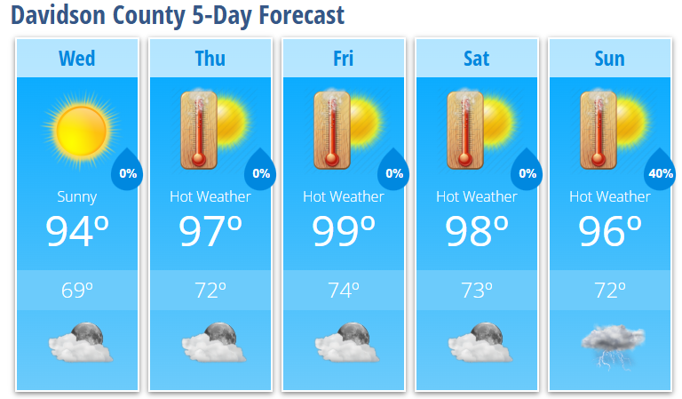
Wednesday
Sunny with a high near 94°. Calm wind.
Wednesday Night
Mostly clear with a low around 69°.
Thursday
Sunny and hot with a high near 97°. Heat index values as high as 101°. Light southeast wind during the afternoon.
Thursday Night
Mostly clear with a low around 72°.
Friday
Sunny and hot with a high near 99°.
Friday Night
Mostly clear with a low around 74°.
Independence Day (Saturday)
Sunny and hot with a high near 98°.
Saturday Night
Partly cloudy with a low around 73°.
Sunday
A 40% chance of showers and thunderstorms after 2 PM. Mostly sunny with a high near 96°.
Sunday Night
A 40% chance of showers and thunderstorms. Mostly cloudy with a low around 72°.
Dangerous Heat Through the Holiday
A strengthening ridge of high pressure will dominate the weather pattern through Independence Day, bringing several consecutive days of above-normal temperatures across Davidson County.
Afternoon highs will reach the mid to upper 90s, while heat index values climb to 100 to 101 degrees. Even though humidity levels won't be excessively high, the prolonged stretch of hot weather will increase the risk of heat-related illnesses.
If you're planning to attend fireworks, festivals, sporting events, or backyard cookouts, remember to:
- Stay well hydrated throughout the day.
- Take frequent breaks in the shade or air conditioning.
- Wear lightweight, light-colored clothing.
- Avoid strenuous outdoor activities during the hottest part of the afternoon when possible.
- Never leave children or pets inside a parked vehicle.
A More Typical Summer Pattern Returns
Confidence continues to increase that the upper-level ridge will weaken and move offshore late this weekend.
As this happens:
- Afternoon temperatures will settle back into the lower and middle 90s.
- Daily shower and thunderstorm chances will return beginning Sunday.
- Humidity levels will increase.
- Some storms may produce gusty winds and small hail, which is typical during the summer months.
While it won't be a dramatic cooldown, the return of scattered thunderstorms should help provide some relief from the prolonged heat.
Looking Ahead
The Independence Day forecast continues to look hot and dry for Davidson County, making for excellent weather for fireworks and outdoor celebrations.
By Sunday and into early next week, expect a return to a more familiar summer pattern with scattered afternoon thunderstorms and temperatures closer to normal for early July.