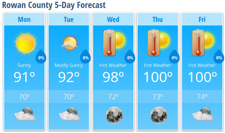
Rowan County Forecast: Dangerous Heat Building Through the Holiday Week
Summer is about to turn up the heat across Rowan County as a strengthening area of high pressure settles over the eastern United States. Temperatures will climb each day, with highs reaching the upper 90s to around 100 degrees by Thursday and Friday. When humidity is factored in, heat index values will likely exceed 100 degrees, making outdoor activities increasingly dangerous during the afternoon hours.
Forecast
Monday
Sunny with a high near 91°. Light northeast winds develop during the morning.
Tonight: Mostly clear with a low around 70°.
Tuesday
Mostly sunny and another warm day with a high near 92°.
Tuesday Night: Mostly clear with a low around 70°.
Wednesday
Sunny and becoming significantly hotter with a high near 98°.
Wednesday Night: Clear with a low around 72°.
Thursday
Sunny and dangerously hot with a high near 100°.
Thursday Night: Clear with a low around 73°.
Friday
Sunny and extremely hot with another high near 100°.
Friday Night: Mostly clear with a low around 74°.
Heat Headlines
The biggest weather story this week will be the prolonged stretch of dangerous heat.
Afternoon heat index values will steadily climb above 100° across Rowan County beginning midweek, with the hottest conditions expected Thursday through the Independence Day holiday weekend. While exact heat index values will depend on afternoon humidity, conditions may approach Heat Advisory criteria by late week.
If you have outdoor plans:
- Drink plenty of water throughout the day.
- Take frequent breaks in the shade or air conditioning.
- Limit strenuous outdoor activity during the hottest part of the afternoon.
- Never leave children or pets inside a parked vehicle, even for a few minutes.
- Check on elderly family members and neighbors who may not have adequate cooling.
Rain Chances
Unlike recent weeks, rain chances will be very limited across Rowan County. A few isolated showers or thunderstorms may develop over the mountains each afternoon, but the strengthening ridge of high pressure should keep most of the Piedmont dry through at least Friday.
Looking Ahead
There is little indication that this pattern will change anytime soon. The prolonged heat is expected to continue through the Fourth of July holiday weekend, making this one of the hottest stretches of weather we've experienced so far this summer. Anyone with holiday plans should be prepared for dangerous afternoon heat while continuing to monitor the latest forecast for any updates.