Weekend Storm Chances Continue Before Dangerous Heat Builds Next Week
After another warm and humid start to the day, I'm continuing to monitor the potential for scattered showers and thunderstorms this afternoon and evening across Rowan County. While not everyone will see rain, any storm that develops could become strong, with the primary threat being damaging wind gusts.
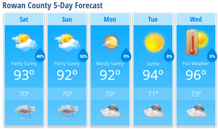
Today will feature a mix of sunshine and clouds with temperatures climbing to around 93 degrees. The atmosphere will become increasingly unstable through the afternoon, allowing scattered thunderstorms to develop after about 4:00 PM. Coverage won't be widespread, but storms that do form will have the potential to produce strong wind gusts, heavy rainfall, frequent lightning, and localized flooding in poor drainage areas.
Storm chances will continue into the evening before gradually diminishing overnight. A few lingering showers remain possible through around 1:00 AM before skies slowly begin to clear. Areas of patchy fog may develop toward daybreak Sunday where rainfall occurs. Overnight lows will settle near 70 degrees.
Sunday brings another opportunity for scattered afternoon and evening thunderstorms. High temperatures will once again reach the lower 90s, although cloud cover and any leftover morning clouds could keep some locations slightly cooler. At this point, the severe weather threat appears lower than today, but I'll continue monitoring for any organized clusters of storms moving into the area during the afternoon or evening.
Once we move into Monday, a significant pattern change begins.
An expanding dome of high pressure will build across the eastern United States, bringing hotter temperatures and gradually reducing our daily storm chances. Monday remains mostly sunny with a high around 92 degrees, followed by 94 degrees Tuesday and 96 degrees Wednesday.
While temperatures will certainly be hot, the bigger concern will be the increasing humidity. Heat index values are expected to climb above 100 degrees across much of the Piedmont by the middle of next week, and several consecutive days of dangerous heat are becoming increasingly likely.
If this forecast holds, outdoor workers, athletes, and anyone planning early Independence Day activities should begin preparing now for prolonged heat.
Rowan County Forecast
Today
- Mostly sunny and hot.
- High: 93°
- 30% chance of afternoon and evening thunderstorms after 4 PM.
- A few storms could become strong with damaging wind gusts.
Tonight
- 40% chance of showers and thunderstorms early.
- Patchy fog possible late.
- Low: 70°
Sunday
- Partly sunny.
- High: 92°
- 30% chance of afternoon thunderstorms.
Sunday Night
- Partly cloudy.
- 30% chance of evening thunderstorms.
- Low: 70°
Monday
- Mostly sunny.
- High: 92°
Tuesday
- Sunny.
- High: 94°
Wednesday
- Sunny and hot.
- High: 96°
What I'm Watching
- This afternoon and evening: Isolated strong to severe thunderstorms capable of producing damaging wind gusts.
- Sunday: Another round of scattered storms remains possible, although confidence in timing and coverage is lower.
- Next week: A prolonged stretch of dangerous heat appears increasingly likely, with heat index values exceeding 100 degrees by midweek and potentially continuing into the Independence Day holiday period.
As always, I'll be monitoring radar throughout the weekend and will provide updates if any strong or severe storms develop or if the heat forecast changes heading into next week.