
Strong Thunderstorm Moving Across Southern Rowan County Through 5:30 PM
The National Weather Service has issued a Special Weather Statement for southern Rowan County as a strong thunderstorm moves through the area until 5:30 PM.
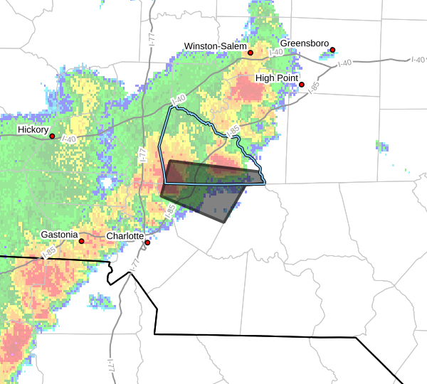
At 5:04 PM, Doppler radar indicated a strong thunderstorm near Kannapolis, moving east at 30 mph.
The primary hazard with this storm is wind gusts of 50 to 55 mph.
Communities that may be impacted include Kannapolis, China Grove, Landis, Enochville, Rockwell, Faith, along with nearby areas including Downtown Concord, Mount Pleasant, West Concord, and the Coddle Creek Reservoir.
While this storm remains below severe warning criteria, wind gusts of 50 to 55 mph are capable of breaking tree limbs, blowing around unsecured outdoor objects and causing isolated power outages.
Heavy rain and frequent lightning will also accompany the storm as it continues moving east.
If you are outdoors in southern Rowan County, move inside a sturdy building until the storm passes. Avoid being outside during lightning and be prepared for rapidly changing weather conditions.
I will continue monitoring this storm and provide additional updates if it strengthens or if any warnings are issued for Rowan County.