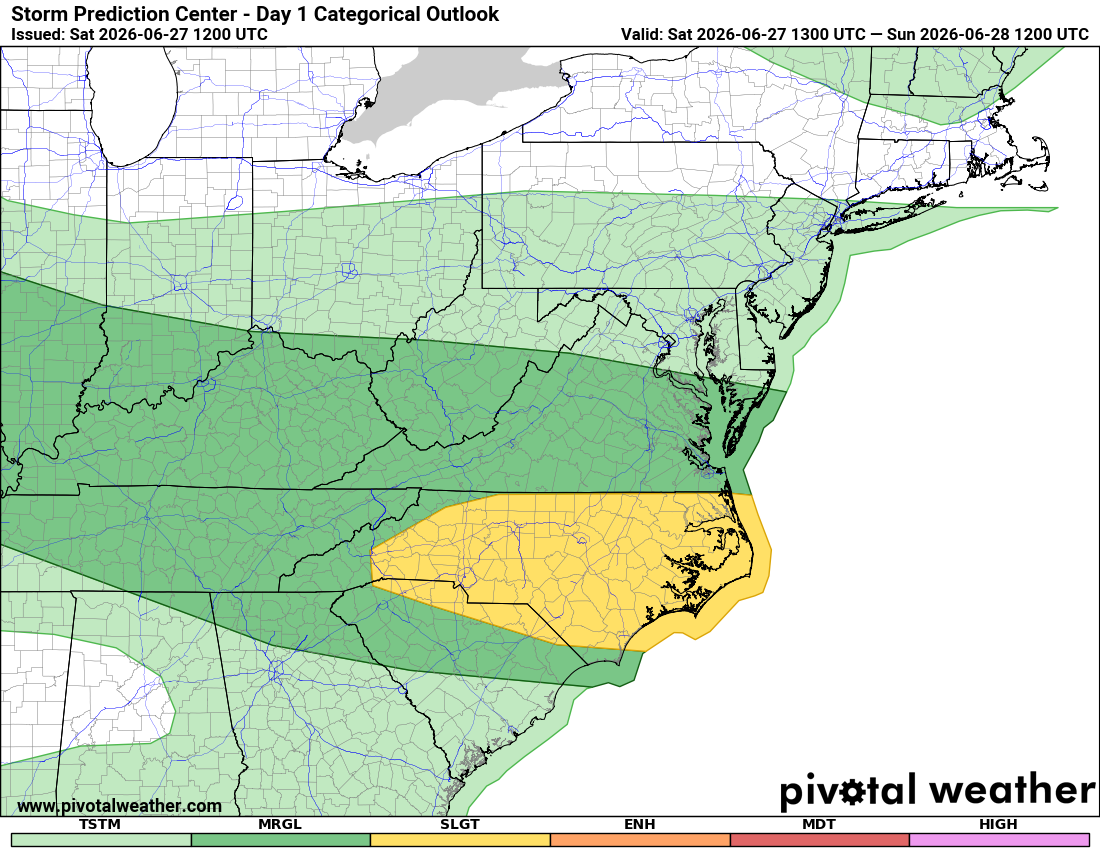
Slight Risk for Severe Storms Includes Rowan, Davie and Davidson Counties This Afternoon and Evening
The National Weather Service has placed Rowan, Davie and Davidson Counties under a Level 2 of 5 Slight Risk for severe thunderstorms this afternoon and evening.
A Slight Risk means scattered severe storms are possible, and while not everyone will experience severe weather, a few storms could become strong enough to produce damaging impacts.
The greatest concern today is damaging wind gusts, which could bring down trees, damage power lines and lead to scattered power outages. Frequent lightning and heavy downpours will accompany any thunderstorms, and localized flash flooding is possible where storms repeatedly move over the same area.
The current forecast calls for thunderstorms to develop during the afternoon, with the greatest threat occurring between 4:00 PM and 9:00 PM. Storms may develop in multiple rounds, and the exact timing and location of the strongest storms will depend on how the atmosphere evolves through the day.
Today's severe weather threat extends across much of the western Carolinas and northeast Georgia. In North Carolina, the Slight Risk includes much of the western Piedmont, including Rowan, Davie and Davidson Counties.
Another round of thunderstorms is possible on Sunday, although today's storm activity may influence how widespread or intense Sunday's storms become.
Looking beyond the weekend, attention will quickly shift to the heat. High pressure is expected to strengthen across the eastern United States next week, pushing afternoon temperatures well into the 90s. Heat index values above 100 degrees are becoming increasingly likely across the Piedmont by the middle of the week, and the hot pattern could continue into the Independence Day holiday weekend.
I'll be monitoring conditions closely throughout the day and will provide updates if severe thunderstorm warnings are issued or storms begin organizing as they move toward Rowan, Davie or Davidson Counties.
What You Should Do Today
- Stay weather aware this afternoon and evening.
- Make sure you have multiple ways to receive severe weather warnings.
- Secure loose outdoor items that could be blown around by strong winds.
- If a Severe Thunderstorm Warning is issued for your location, move indoors and stay away from windows until the storm passes.
- Be prepared for isolated power outages if damaging winds develop.