Weekend Severe Weather Outlook: Here's What I'm Watching for Saturday
As we head into the weekend, I wanted to share what I'm watching regarding Saturday's severe weather potential across Rowan, Davie, and Davidson counties.
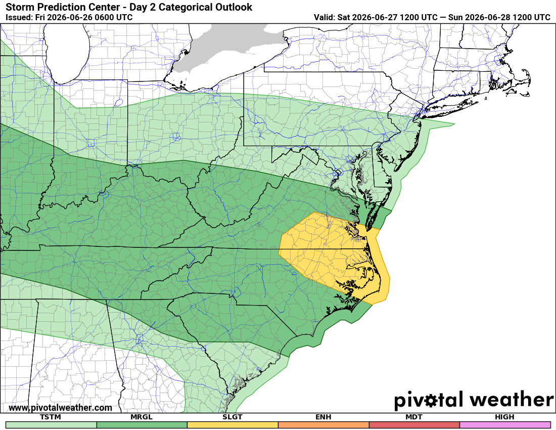
The overall severe weather threat has decreased slightly since yesterday. The Storm Prediction Center has downgraded Rowan, Davie, and Davidson counties to a Level 1 of 5 Marginal Risk for severe thunderstorms on Saturday.
While that means widespread severe weather is not expected, a few storms could still become strong or severe, so Saturday's forecast deserves your attention.
What's Changed?
Yesterday, portions of our area were included in a Level 2 of 5 Slight Risk. New forecast data suggests the greater severe weather threat has shifted slightly, resulting in our local counties being placed under a Marginal Risk.
This doesn't mean severe weather is off the table. Instead, it means only isolated severe storms are expected rather than scattered severe storms.
Timing
The atmosphere will become increasingly unstable during the afternoon as temperatures climb into the lower 90s.
Current timing looks like:
- Morning: Dry with a mix of sun and clouds.
- Early Afternoon (2 PM - 4 PM): Storms begin developing.
- Late Afternoon into Early Evening (4 PM - 8 PM): Highest chance for thunderstorms, including the potential for a few strong storms.
- Saturday Night: Storms gradually diminish after sunset.
I'll continue monitoring radar and updated forecast guidance as we move closer to Saturday.
Primary Hazards
If stronger storms develop, the greatest concerns will be:
Damaging wind gusts capable of bringing down tree limbs and causing isolated power outages.
Frequent cloud-to-ground lightning, which can occur well away from the heaviest rain.
Brief heavy rainfall, leading to ponding of water on roads and reduced visibility.
Large hail and tornadoes appear to be lower-end threats at this time, but as always with summertime thunderstorms, they can't be completely ruled out.
My Confidence
Confidence is moderate that scattered thunderstorms will develop Saturday afternoon.
Confidence is lower regarding exactly where the strongest storms will form. That's typical with summertime weather patterns, where small-scale boundaries can determine which communities experience stronger storms while others stay dry.
Most neighborhoods won't experience severe weather, but the storms that do become stronger could produce localized impacts.
What I'll Be Watching
As we move through today and into Saturday morning, I'll be monitoring:
- Whether storms develop earlier than expected.
- How unstable the atmosphere becomes during the afternoon.
- Any changes in the severe weather outlook from the Storm Prediction Center.
- Radar trends that could indicate clusters of storms moving toward our area.
If the forecast changes significantly, I'll have updates posted throughout the day.
Bottom Line
Saturday is not expected to be a washout, and many hours of the day will be dry.
However, if you have outdoor plans during the afternoon or early evening, be prepared to move indoors quickly if thunderstorms approach.
With Rowan, Davie, and Davidson counties now under a Level 1 of 5 Marginal Risk, the overall threat is lower than previously forecast, but it only takes one stronger storm to produce damaging winds, dangerous lightning, and heavy rain.
I'll continue watching the latest forecast trends and keep you updated if anything changes.