ROWAN COUNTY FORECAST
Good evening Rowan County!
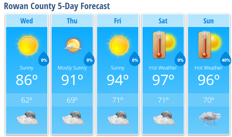
A cold front that moved through the area today is delivering exactly what many of us needed: a brief break from the heat and humidity. The next 48 hours will feature some of the nicest weather we've experienced in weeks before summer heat rapidly returns for the weekend.
WEDNESDAY
Sunny
High: 86°
Light and variable wind
Lower humidity
WEDNESDAY NIGHT
Increasing clouds
Low: 62°
THURSDAY
Mostly sunny
High: 91°
South southwest wind 5-7 mph
THURSDAY NIGHT
Mostly clear
Low: 69°
FRIDAY
Sunny and hot
High: 94°
FRIDAY NIGHT
Partly cloudy
Low: 71°
SATURDAY
Mostly sunny and hot
High: 97°
SATURDAY NIGHT
Partly cloudy
Low: 71°
SUNDAY
Hot with a 40% chance of afternoon thunderstorms
High: 96°
WHAT I'M WATCHING
Wednesday will be the pick day of the week. Lower humidity, sunshine, and highs in the mid-80s will make it feel much more comfortable than what we've experienced recently.
The warming trend begins Thursday and accelerates into the weekend. Temperatures will climb from 91° Thursday to the mid and upper 90s by Saturday and Sunday.
Heat index values will likely exceed 100 degrees this weekend. While forecast temperatures have trended down slightly compared to previous forecasts, the combination of heat and humidity will still create potentially dangerous conditions during the afternoon hours.
Afternoon and evening thunderstorm chances return by the end of the weekend as moisture slowly increases across the Carolinas. Coverage currently looks scattered, but any storm could provide localized relief from the heat.
BOTTOM LINE
Enjoy Wednesday.
The cooler, drier air behind today's cold front won't last long. Temperatures begin climbing Thursday before reaching their highest levels of the summer so far this weekend. If you have outdoor plans Saturday or Sunday, be prepared for prolonged heat and make sure you're staying hydrated.
-
Steve Monday
Chief Forecaster
Rowan County Weather -