Davie County Weather Forecast
A Few More Storms Tuesday, Then a Beautiful Midweek Break
Good Monday evening, Davie County!
After today's active weather, Tuesday will serve as a transition day as a cold front slowly exits the region. While additional showers and thunderstorms remain possible, conditions improve significantly by Wednesday before summer heat begins building again later this week.
Tuesday: Unsettled but Not a Washout
Tuesday starts with lingering moisture and a chance for additional showers throughout the day.
Expect partly sunny skies with temperatures reaching around 87 degrees during the afternoon.
Rain chances remain around 50%, with thunderstorms possible after 2 PM as the cold front continues pushing southeast.
Not everyone will see rainfall, but any storms that develop could produce brief heavy downpours and lightning. Rainfall amounts could range from a quarter to one-half inch in areas that see repeated storms.
Northwest winds will develop during the morning and help usher in slightly drier air by evening.
Tuesday Night: Much More Comfortable
By Tuesday evening, any lingering showers and thunderstorms should come to an end.
Skies will become mostly clear overnight with temperatures falling to around 62 degrees.
After several warm and humid nights, Tuesday night should feel noticeably more comfortable.
Wednesday: The Best Day Of The Week
Wednesday looks fantastic across Davie County.
Sunny skies
High near 88°
Lower humidity
Low near 65°
High pressure building into the region will provide a brief break from both the storm chances and the summer humidity.
If you have outdoor plans this week, Wednesday is the day to take advantage of.
Heat Begins Building Again
The quiet weather won't last long.
Thursday remains mostly sunny with highs climbing back into the lower 90s.
By Friday, isolated afternoon thunderstorms return as temperatures climb into the mid 90s.
Weekend Preview
Summer heat returns in full force by the weekend.
Friday: 94°
Saturday: 95°
Heat index values over 100° possible
While rain chances remain relatively low, temperatures will continue trending upward and may require closer monitoring for heat-related concerns by late weekend.
My Take
Tuesday is a transition day with a few lingering showers and thunderstorms possible before much drier air arrives.
Wednesday remains the standout day of the forecast period with sunshine, comfortable humidity levels, and seasonable temperatures.
The bigger story then becomes the return of summer heat as we head toward the weekend, with highs likely climbing back into the middle 90s and heat index values potentially exceeding 100 degrees.
Davie County Forecast
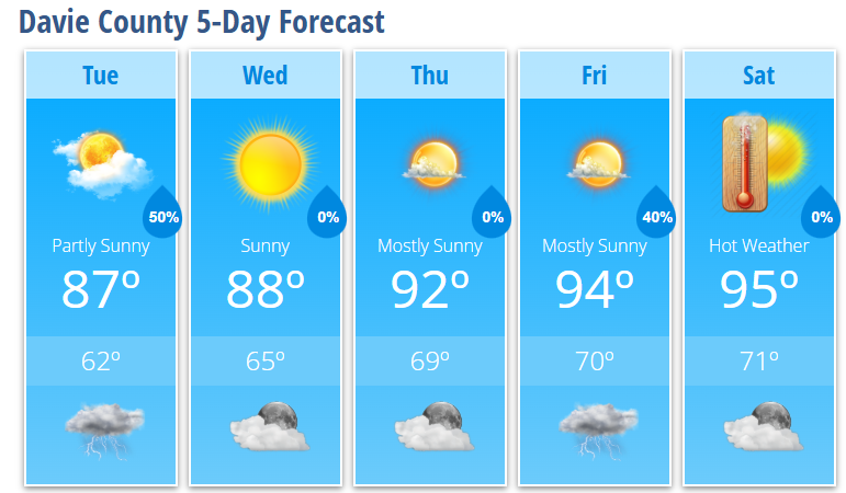
Tuesday: 50% chance of showers and thunderstorms, high 87°
Tuesday Night: Mostly clear, low 62°
Wednesday: Sunny, high 88°
Wednesday Night: Mostly clear, low 65°
Thursday: Mostly sunny, high 92°
Thursday Night: Mostly clear, low 69°
Friday: 40% chance of afternoon thunderstorms, high 94°
Friday Night: 30% chance of thunderstorms, low 70°
Saturday: Mostly sunny and hot, high 95°
Saturday Night: Partly cloudy, low 71°