Tropical System Still Expected to Bring Wind, Rain Chances, and Isolated Severe Weather Threat Thursday Into Friday
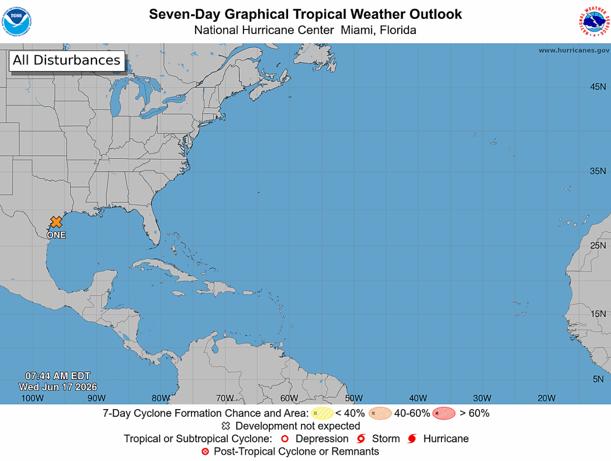
As I've been discussing over the past several days, Potential Tropical Cyclone One continues to move along the western Gulf Coast this morning and remains on track to influence our weather across the Carolinas late Thursday into Friday.
The good news is that direct tropical impacts across Rowan County, Davie County, and Davidson County remain unlikely. However, this system will still bring several weather concerns that I'll be monitoring closely over the next 24 to 36 hours.
Gusty Winds Likely Thursday
At this point, my greatest confidence is in a windy day Thursday.
Even before any showers or thunderstorms develop, southwest winds will increase significantly across the region. Sustained winds of 15 to 20 mph are expected at times, with afternoon wind gusts generally ranging from 25 to 35 mph across the Piedmont.
These winds are not directly related to the tropical system itself but instead are being generated by the overall weather pattern setting up across the eastern United States. Regardless of the cause, you'll want to secure lightweight outdoor objects, especially if you have patio furniture, umbrellas, or other items that could be blown around.
Heavy Rain Potential Remains Uncertain
Rain chances will increase Thursday afternoon and continue into Friday morning as tropical moisture moves northward into the Carolinas.
The latest forecast guidance continues to suggest the heaviest rainfall will remain south of our area, focusing across portions of South Carolina and Georgia. However, it would not take much of a shift in the position of the stalled front to bring heavier rainfall farther north into the western Carolinas.
Right now, I believe beneficial rainfall remains likely across Rowan County and surrounding areas, but widespread drought-busting rainfall is far from guaranteed. While isolated flooding cannot be ruled out where heavier downpours occur, confidence remains low regarding exact rainfall amounts.
Severe Weather Threat Bears Watching
Another aspect of this forecast that I'll be monitoring closely is the potential for isolated severe thunderstorms Thursday afternoon through early Friday morning.
The National Weather Service indicates that enhanced wind shear ahead of the remnants of Potential Tropical Cyclone One could support isolated pockets of damaging wind if thunderstorms are able to organize. Confidence remains relatively low because the exact track of the remnant circulation is still uncertain.
At this time, damaging straight-line winds would be the primary severe weather concern. The severe weather threat appears lower on Friday as a cold front is now expected to move through faster than earlier forecasts suggested.
My Current Thoughts
As of Wednesday morning, I remain most concerned about gusty winds Thursday, followed by the potential for localized heavy rainfall and isolated strong thunderstorms Thursday evening into Friday morning.
The overall trend continues to suggest that the heaviest rainfall stays south of Rowan County and much of the western Piedmont. While I do expect some beneficial rainfall, I'm not seeing strong evidence that this system will provide significant drought relief for our area.
I'll continue monitoring new forecast data throughout today and tonight and will provide additional updates as confidence increases regarding rainfall amounts and any severe weather concerns.
For now, enjoy today's sunshine because our weather pattern becomes much more active beginning Thursday afternoon.