
Strong Thunderstorm Moving Across Portions of Davidson, Montgomery, Randolph, and Stanly Counties
A strong thunderstorm is moving across portions of the southern Piedmont this afternoon and could bring gusty winds, small hail, and heavy rain to parts of Davidson, Montgomery, Randolph, and Stanly counties through 5:30 PM.
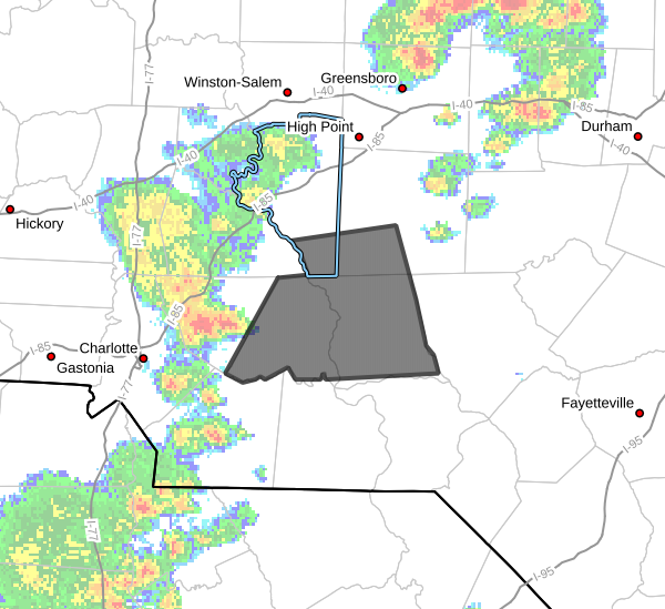
According to the National Weather Service, Doppler radar at 4:25 PM indicated a strong thunderstorm near Mount Pleasant, approximately 7 miles east of Downtown Concord, moving east at 35 mph.
Main Threats
The strongest impacts with this storm are expected to be:
Wind gusts between 50 and 55 mph
Pea-size hail
Brief heavy downpours
While this storm is not currently severe warned, wind gusts of this magnitude can still knock down small tree limbs, blow around unsecured outdoor objects, and create hazardous driving conditions.
Minor hail damage to vegetation is also possible.
Areas Impacted
Communities that may be impacted by this storm include:
- Albemarle
- Troy
- Badin Lake
- Biscoe
- Plyler
- Midland
- Locust
- Norwood
- Badin
- Oakboro
Motorists traveling along Interstate 73 between Mile Markers 37 and 71 should also be prepared for sudden reductions in visibility and gusty winds as the storm moves through the area.
Safety Reminder
If you are outdoors and hear thunder, move indoors immediately. Strong thunderstorms can produce dangerous lightning strikes well away from the heaviest rain.
Residents in the path of this storm should secure loose outdoor items and remain alert for changing weather conditions through the late afternoon.
Rowan County Weather will continue monitoring radar trends and provide updates if additional strong storms develop across the region.