National Hurricane Center Monitoring Disturbance That Could Reach Gulf Waters Later This Week
The National Hurricane Center is continuing to monitor a broad area of low pressure over eastern Mexico, but development is not expected in the short term.
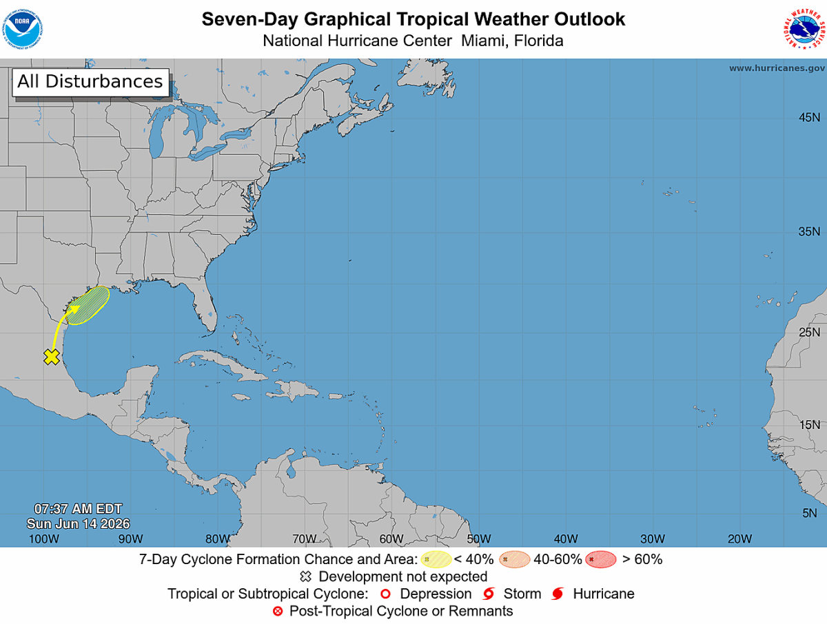
According to the latest Tropical Weather Outlook issued Sunday morning, the system is currently producing disorganized showers and thunderstorms across portions of eastern Mexico. The disturbance is expected to remain inland over northeastern Mexico and southern Texas through at least the next day or so, limiting any opportunity for tropical development.
At this time, the National Hurricane Center gives the system a near 0% chance of tropical development over the next 48 hours.
What Happens Next?
Forecast guidance suggests the area of low pressure could move back over the northwestern Gulf of America around the middle of the week.
As the system emerges over water, it may interact with a stalled frontal boundary across the region. While that interaction could help increase shower and thunderstorm activity, environmental conditions are currently expected to be only marginally favorable for tropical development.
Because of those limiting factors, the National Hurricane Center assigns only a 20% chance of development over the next seven days.
No Immediate Threat to the Carolinas
At this time, there are no direct impacts expected for North Carolina or the Carolinas from this system.
However, it serves as a reminder that hurricane season is now underway, and Rowan County Weather will continue monitoring all areas of the Atlantic Basin, Caribbean Sea, and Gulf of America for any signs of tropical development.
Key Takeaways
A broad area of low pressure is located over eastern Mexico.
The system is currently producing disorganized showers and thunderstorms.
Tropical development is not expected through the next 48 hours.
The National Hurricane Center gives the system a 20% chance of development over the next seven days.
No impacts are expected for North Carolina at this time.
As always, I'll continue monitoring the tropics and provide updates if development chances increase or if any future impacts to the Carolinas become possible.