Severe Weather Risk Expanded Across Rowan, Davie, and Davidson Counties Today
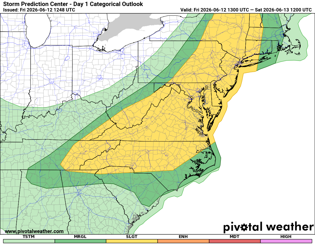
ROWAN COUNTY, N.C. — Forecasters at the Storm Prediction Center have placed Rowan, Davie, and Davidson counties under a Slight Risk (Level 2 of 5) for severe thunderstorms today and this evening.
The upgrade comes as a hot and humid air mass remains in place across the Carolinas, creating an environment capable of producing scattered strong to severe thunderstorms later this afternoon and evening.
What Does a Slight Risk Mean?
A Slight Risk indicates that scattered severe thunderstorms are possible within the risk area.
While not everyone will experience severe weather, conditions are favorable for storms capable of producing damaging winds and other severe weather hazards.
Primary Threat: Damaging Winds
The main concern across central North Carolina today will be damaging straight-line wind gusts.
The Storm Prediction Center notes that very strong daytime heating combined with high humidity levels will create an unstable atmosphere. As thunderstorms develop, they may produce powerful downbursts capable of knocking down tree limbs, causing isolated power outages, and creating hazardous travel conditions.
Wind gusts over 58 mph meet severe thunderstorm criteria.
Timing
The greatest threat for severe weather appears to be:
4 PM through 10 PM
Storms are expected to develop during the late afternoon and continue into the evening hours as clusters move across the region.
Not everyone will see a thunderstorm, but any storm that develops will have the potential to become strong quickly.
Additional Threats
While damaging winds are the primary concern, a few storms could also produce:
Frequent cloud-to-ground lightning
Heavy rainfall
Small hail
Localized flooding in poor drainage areas
The tornado threat appears very low at this time.
Why Today?
Several ingredients are coming together across the Carolinas:
- Temperatures climbing into the mid and upper 90s
- Heat index values exceeding 100 degrees
- High humidity levels
- Increasing energy in the atmosphere from an approaching weather disturbance
These factors will help fuel thunderstorm development later today.
What Should You Do?
Before storms develop this afternoon:
Secure loose outdoor items.
Have multiple ways to receive weather warnings.
Keep mobile devices charged.
Be prepared to move indoors quickly if thunderstorms approach.
Remember, if you can hear thunder, you are close enough to be struck by lightning.
Rowan County Weather Bottom Line
Rowan, Davie, and Davidson counties are under a Slight Risk (Level 2 of 5) for severe weather today.
Damaging wind gusts are the primary threat.
Scattered thunderstorms are expected to develop late this afternoon and evening.
The greatest threat window appears to be between 4 PM and 10 PM.
Stay weather aware and monitor forecasts throughout the day as conditions evolve.