
Strong Thunderstorm Moving Across Davidson County This Afternoon
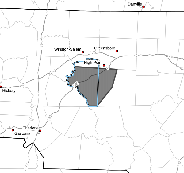
The National Weather Service has issued a Special Weather Statement for portions of Davidson and northwestern Randolph Counties as a strong thunderstorm moves through the area this afternoon.
As of 3:48 PM, Doppler radar indicated a strong thunderstorm located near Linwood, moving east at around 30 mph.
What To Expect
This storm is capable of producing:
- Wind gusts up to 40 mph
- Pea-sized hail
- Heavy rainfall
- Frequent lightning
While this is not currently a severe thunderstorm warning, gusty winds may still be strong enough to knock down small tree limbs and blow around unsecured outdoor objects. Minor hail damage to vegetation is also possible.
Areas Impacted
Communities that could be impacted include:
- Lexington
- Thomasville
- High Point
- Archdale
- Trinity
- Denton
- Linwood
- Gordontown
- Areas near High Rock Lake
- Randleman Regional Reservoir Marina
Travelers along Interstate 85 between mile markers 84 and 112 should also expect periods of heavy rain and gusty winds.
Safety Reminder
Remember that strong winds can arrive before the heaviest rainfall begins. If you hear thunder or see darkening skies:
- Move indoors immediately
- Stay away from windows
- Avoid open areas outdoors
- Secure loose outdoor items if possible
Heavy rain and lightning will continue to be possible through the late afternoon and early evening across portions of central North Carolina as additional showers and storms develop along a cold front moving through the region.
Rowan County Weather will continue monitoring conditions and provide additional updates if warnings are issued.