
Severe Thunderstorm Warning Issued for Western Rowan County Until 10 AM
The National Weather Service in Greenville-Spartanburg has issued a Severe Thunderstorm Warning that includes western Rowan County.
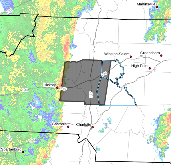
The warning is in effect until 10:00 AM EDT.
The warning also includes Catawba, Alexander, Iredell, and western Davie counties.
Storm Location and Movement
At 9:01 AM, Doppler radar indicated a line of severe thunderstorms extending from near Taylorsville to north of Lincolnton, moving east at 35 mph.
This line of storms is expected to continue moving across the western Piedmont through the morning hours.
Main Hazard
The primary threat with this storm is:
-
Wind gusts up to 60 mph
Potential Impacts
Strong winds could:
-
Knock down trees and tree limbs
-
Damage power lines
-
Cause scattered power outages
Residents should be prepared for rapidly changing conditions as the storms move through.
Communities in the Path
Communities impacted by this line of storms include:
-
Statesville
-
Newton
-
Taylorsville
-
Mooresville
-
St. Stephens
-
Conover
-
Maiden
-
Enochville
-
Troutman
-
Stony Point
Portions of western Rowan County, including areas near Enochville, could experience strong winds as the storms move east.
Tornado Possible
The National Weather Service notes that a tornado cannot be ruled out with this line of storms as it moves through the region.
Safety Reminder
If storms approach your location:
-
Move to an interior room on the lowest floor of a sturdy building
-
Stay away from windows
-
Remain sheltered until the storm passes
Rowan County Weather Will Continue Monitoring
Rowan County Weather will continue monitoring radar and National Weather Service updates and will post additional alerts if warnings are extended or new storms develop across the area.