Rowan County Included in Monday Severe Weather Outlook
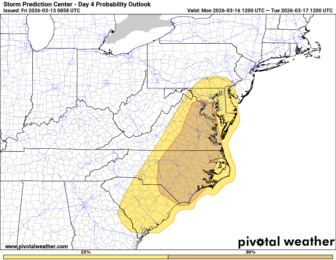
Rowan County is currently included in the 25% severe weather probability area for Monday, and Rowan County Weather is continuing to track the developing storm system that could impact the Carolinas early next week.
While the event is still several days away, forecast models continue to show a strong weather system developing across the eastern United States on Monday that may bring the potential for severe storms to parts of the Carolinas and Mid-Atlantic.
What the Forecast Is Showing
Forecast models are in good agreement showing a deep upper-level trough moving east out of the Mississippi Valley on Monday, eventually lifting toward the Mid-Atlantic and Northeast.
Ahead of the approaching cold front, southerly winds will pull warmer and more humid air northward into the Carolinas. Current projections show dewpoints rising into the lower 60s across the Piedmont, including Rowan County.
That moisture will help create an environment supportive of thunderstorms.
Two Possible Severe Weather Scenarios
There are currently two possible storm scenarios that could develop on Monday.
The first involves isolated storms developing ahead of the cold front during the afternoon hours. If storms can develop in this environment, some could become supercells capable of producing damaging winds or a few tornadoes.
The second scenario involves storms forming along the advancing cold front, potentially organizing into a line of storms capable of producing damaging straight-line winds and embedded tornadoes.
Forecast soundings show very strong winds just above the surface, with wind speeds of 50 to 70 mph at around 5,000 feet, combined with strong wind shear. If enough instability develops, these ingredients could support organized severe storms.
What This Means for Rowan County
At this time, Rowan County sits within the 25% severe weather probability area, meaning there is roughly a 1 in 4 chance of severe weather occurring within 25 miles of any given point in the region.
It is still too early to determine the exact timing or strength of storms locally. Much will depend on how quickly the cold front moves through the region and whether enough daytime heating develops Monday afternoon.
What Happens After the Front
Behind the cold front, cooler and more stable air is expected to move into the Carolinas, which should quickly bring an end to the severe weather threat.
Forecast models suggest quieter weather should return for the remainder of the week once the system moves out of the area.
Rowan County Weather Is Tracking This System
This system is still several days away, and details will continue to evolve. Rowan County Weather will continue tracking forecast trends and updating the community as new information becomes available.
Residents should stay weather aware as we move closer to Monday.