Tropical Update — National Hurricane Center
For the North Atlantic, Caribbean Sea, and Gulf of Mexico:
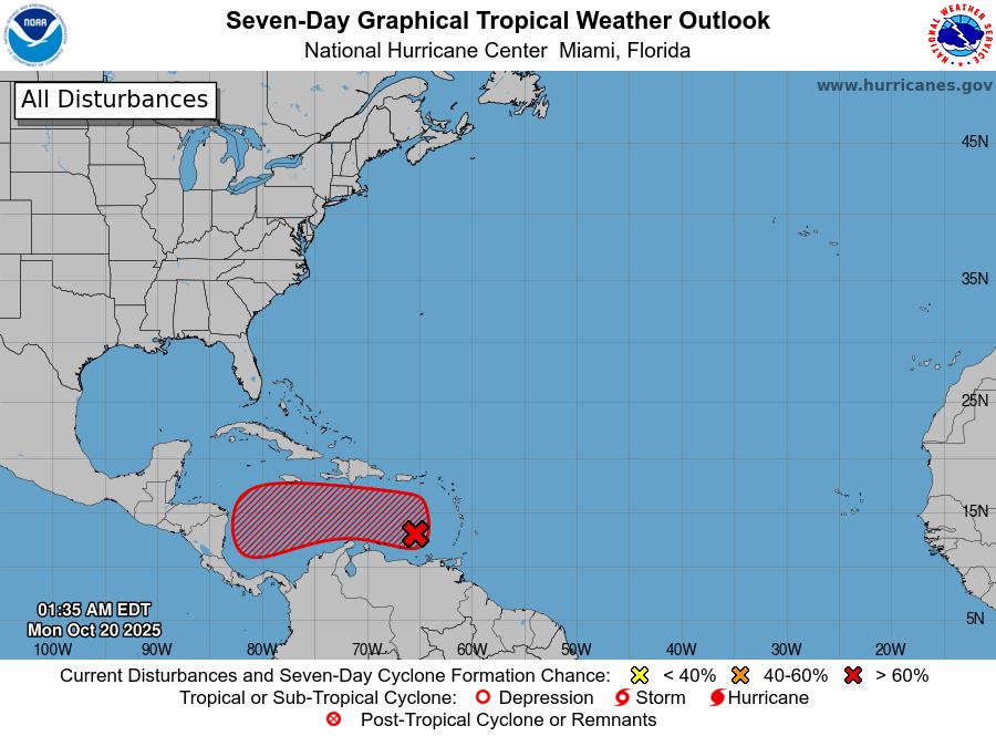
Caribbean Sea (AL98):
A tropical wave located over the eastern Caribbean Sea, a few hundred miles west of the Windward Islands, is producing a large area of poorly organized showers and thunderstorms. Recent satellite-derived wind data indicate the disturbance continues to lack a closed circulation, though it is producing winds of 30 to 40 mph north and east of the wave axis.
The system is moving quickly westward at 20 to 25 mph, which should limit significant development through the next day or so. However, environmental conditions are expected to become more conducive for development as the wave slows over the central Caribbean Sea, and a tropical depression is likely to form during the middle to latter part of this week.
Regardless of development, heavy rainfall and gusty winds will continue affecting portions of the Windward and Leeward Islands this morning.
-
Formation chance through 48 hours: Low (30%)
-
Formation chance through 7 days: High (70%)