Tropical Update from the National Hurricane Center
Friday, October 17, 2025
For the North Atlantic, Caribbean Sea, and the Gulf of Mexico:
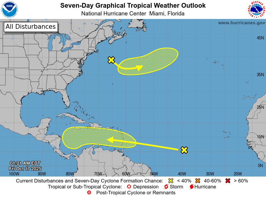
East of the Windward Islands into the Caribbean Sea:
A tropical wave over the central tropical Atlantic is producing a large area of showers and thunderstorms. Some gradual development is possible over the next several days as it moves west at 15 to 20 mph. Regardless of development, heavy rainfall and gusty winds are expected across the Windward Islands late this weekend, with the system moving into the Caribbean early next week.
-
Formation chance through 48 hours: Low (10 percent)
-
Formation chance through 7 days: Low (30 percent)
North Atlantic:
A non-tropical low pressure system is forming several hundred miles south of Nova Scotia, Canada. It is expected to drift southeast before turning northeast this weekend. Some subtropical or tropical development could occur while it tracks over the Gulf Stream northeast of Bermuda. By early next week, the system will move into colder waters, ending its chances for development.
-
Formation chance through 48 hours: Low (10 percent)
-
Formation chance through 7 days: Low (10 percent)
Stay tuned to Rowan County Weather for the latest updates from the National Hurricane Center as we continue through the latter part of hurricane season.