Tropical Update – Friday Morning (October 10)
From the National Hurricane Center
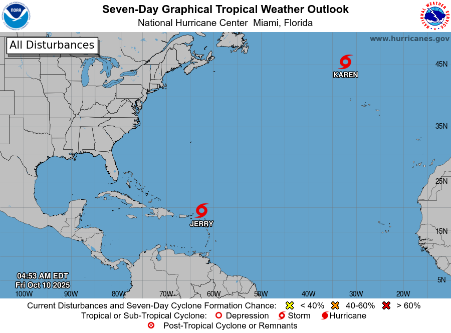
Tropical Storm Jerry remains a disorganized system this morning.
-
Maximum Winds: 45 mph (45 kt)
-
Movement: Northwest at 15 mph
-
Location: North of the Leeward Islands
Jerry continues to battle moderate to strong wind shear, with most of the heavy rain and thunderstorms displaced to the south and east of the center. Heavy rainfall will continue to impact portions of the Leeward Islands, British Virgin Islands, U.S. Virgin Islands, and Puerto Rico through today, creating the potential for flash flooding in urban areas and higher terrain.
The storm will begin turning north later tonight and then northeast over the weekend, keeping its center well southeast of Bermuda by Sunday. Forecasters at the National Hurricane Center no longer expect Jerry to strengthen into a hurricane. Some modest strengthening is possible if wind shear temporarily decreases this weekend.
Elsewhere in the Atlantic:
Subtropical Storm Karen remains over the North Atlantic, embedded within a larger upper-level low-pressure system.
-
Maximum Winds: 40 mph (35–40 kt)
-
Movement: Northeast at 8 mph
Karen is expected to accelerate northeastward through Friday and gradually lose tropical characteristics as it becomes absorbed by an approaching frontal system on Saturday.