Tropical Weather Outlook – National Hurricane Center
Updated: 2:00 AM EDT Wednesday, October 8, 2025
Active Systems:
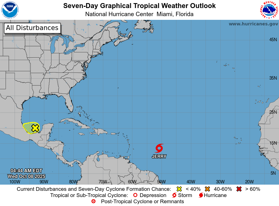
The National Hurricane Center is issuing advisories on Tropical Storm Jerry, located in the central tropical Atlantic.
Southwestern Gulf of Mexico:
A trough of low pressure over the Bay of Campeche is producing widespread showers and thunderstorms.
-
Some slow development is possible before the system moves inland over southern Mexico later today or early Thursday.
-
Regardless of development, heavy rain and gusty winds are likely across portions of southern Mexico through Thursday.
-
Formation chances:
-
48 hours – Low, 10 percent
-
7 days – Low, 10 percent
-
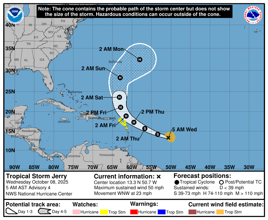
Tropical Storm Jerry – Discussion #4
Jerry remains poorly organized this morning, with its low-level center still partially exposed and convection displaced south and east of the center.
-
Current intensity: 45 knots (50 mph)
-
Movement: West-northwest at 20 knots (23 mph)
-
Location: Central tropical Atlantic
-
Forecast track: Expected to move near or just north of the northern Leeward Islands late Thursday into Friday before turning north and then northeast over the open Atlantic.
Outlook:
Jerry is expected to gradually strengthen and could become a hurricane on Thursday as it slows down and becomes more vertically organized over warm waters. Further strengthening is possible later in the week.
A Tropical Storm Watch remains in effect for parts of the northern Leeward Islands. Residents in the Leeward Islands, Virgin Islands, and Puerto Rico should continue monitoring updates.
Key Messages:
-
Jerry could bring tropical storm conditions to portions of the northern Leeward Islands within the next 48 hours.
-
Heavy rainfall Thursday into early Friday could cause flash flooding, especially in higher terrain areas of the Leeward Islands.
Forecast information courtesy of the National Hurricane Center (NHC).