
A STRONG THUNDERSTORM WILL IMPACT SOUTHEASTERN CATAWBA NORTHEASTERN LINCOLNSOUTHEASTERN IREDELL AND WESTERN ROWAN COUNTIES THROUGH 400 PM EDT
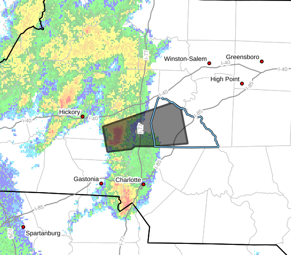
At 325 PM EDT, Doppler radar was tracking a strong thunderstorm 13
miles east of Newton, or near Lake Norman, moving east at 40 mph.
HAZARD...Wind gusts up to 50 mph and pea size hail.
SOURCE...Radar indicated.
IMPACT...Gusty winds could knock down tree limbs and blow around
unsecured objects. Minor hail damage to outdoor objects is
possible.
Locations impacted include...
Westport, Enochville, Mount Ulla, Bandys, Lake Norman, Mooresville,
Piedmont Research Station, Cleveland, Lake Norman State Park, and
Landis.
PRECAUTIONARY/PREPAREDNESS ACTIONS...
If outdoors, consider seeking shelter inside a building.
A Severe Thunderstorm Watch remains in effect until 700 PM EDT for
the Piedmont of North Carolina.
Please let our local sponsors know that you appreciate their support of our blog. Take a moment to visit their website linked at the top of this post.
Share this:

Announcements & Events
Check back often for important announcements and events that I'll be involved in!