

Severe Thunderstorms Possible Monday
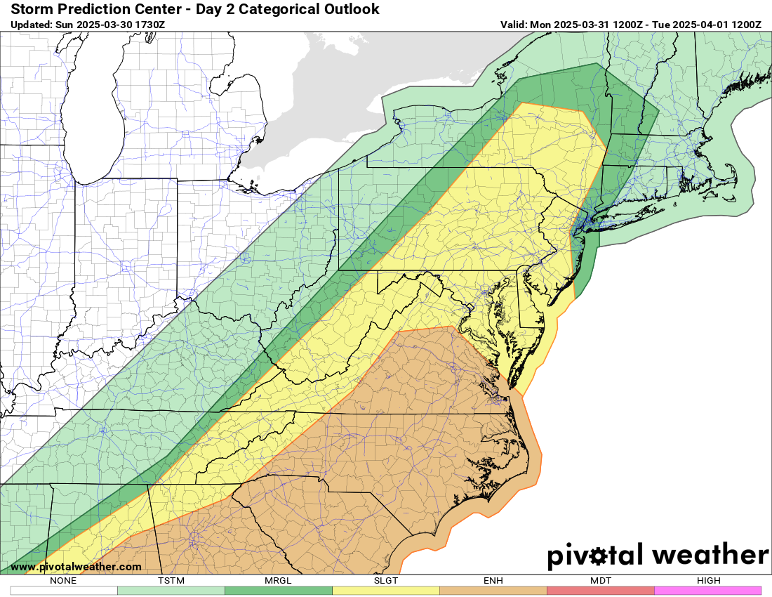
OVERVIEW
A cold front will cross the area Monday, bringing a line of showers and thunderstorms to the region. Several of these storms may be strong to severe, with damaging winds and isolated tornadoes being the main threats.
TIMING
▪ Early afternoon into the early evening Monday, the line of showers and storms will track from west to east across the region.
HAZARDS & IMPACTS
▪ Damaging wind gusts will be the main threat, which may knock down trees and power lines.
▪ Isolated tornadoes and large hail will also be possible.
FORECAST CHALLENGES
▪ Confidence is low as to how storms will evolve across eastern Tennessee and northern Georgia Monday morning, resulting in a conditional severe weather threat.
▪ A complex of storms may push south of the area and disrupt the environment farther north across the western Carolinas and northeast Georgia, resulting in noticeably lower coverage of
storms across the area.
▪ However, should the environment remain unimpeded, a line of severe thunderstorms may push across much of the area, especially east of the mountains.
▪ Regardless, any storms that are able to develop will have the potential to become severe with damaging winds, isolated tornadoes and isolated large hail.
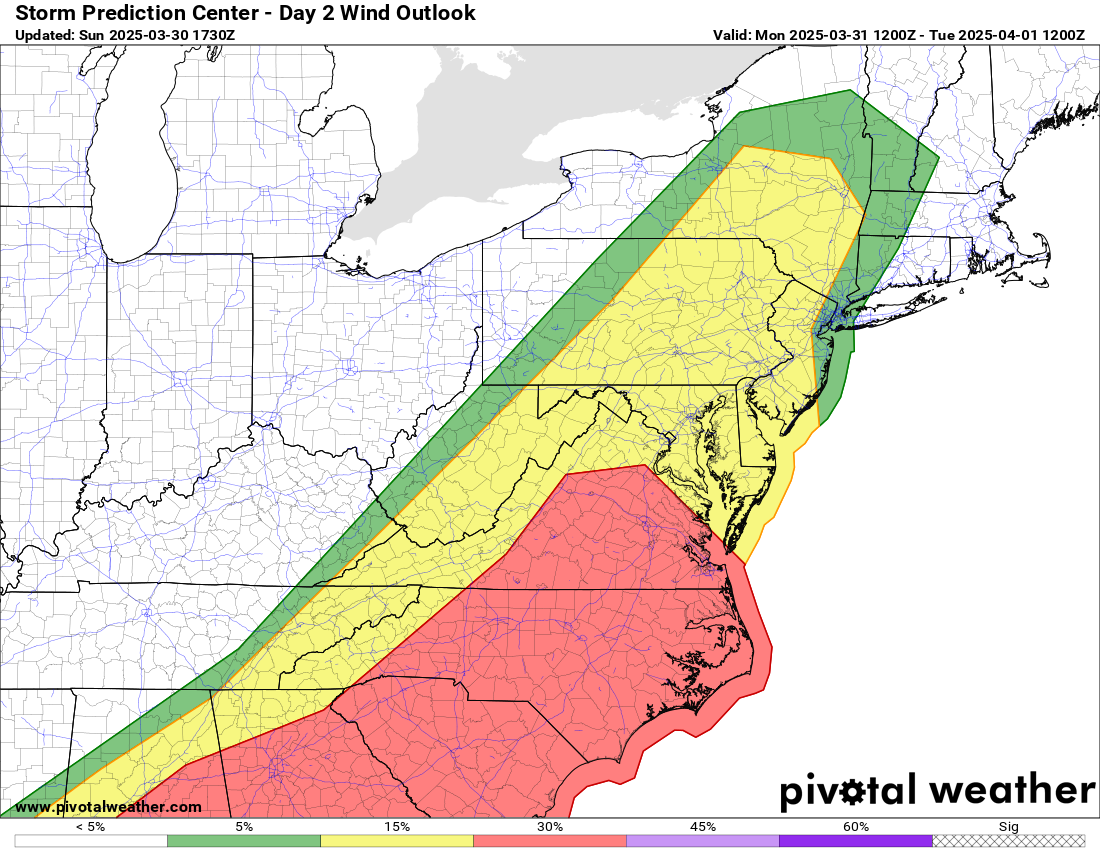
Damaging wind gusts from strong to severe thunderstorms will be the main threat.
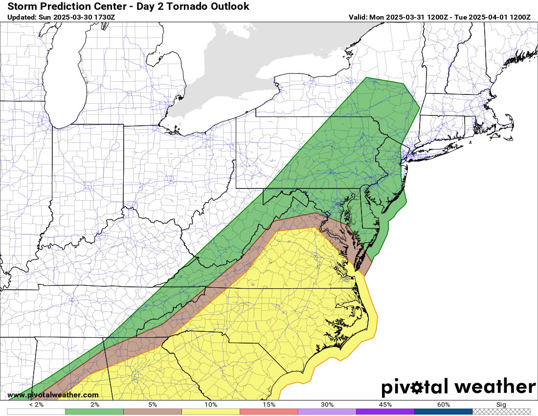
Isolated tornadoes will be possible, especially across the foothills and Piedmont.
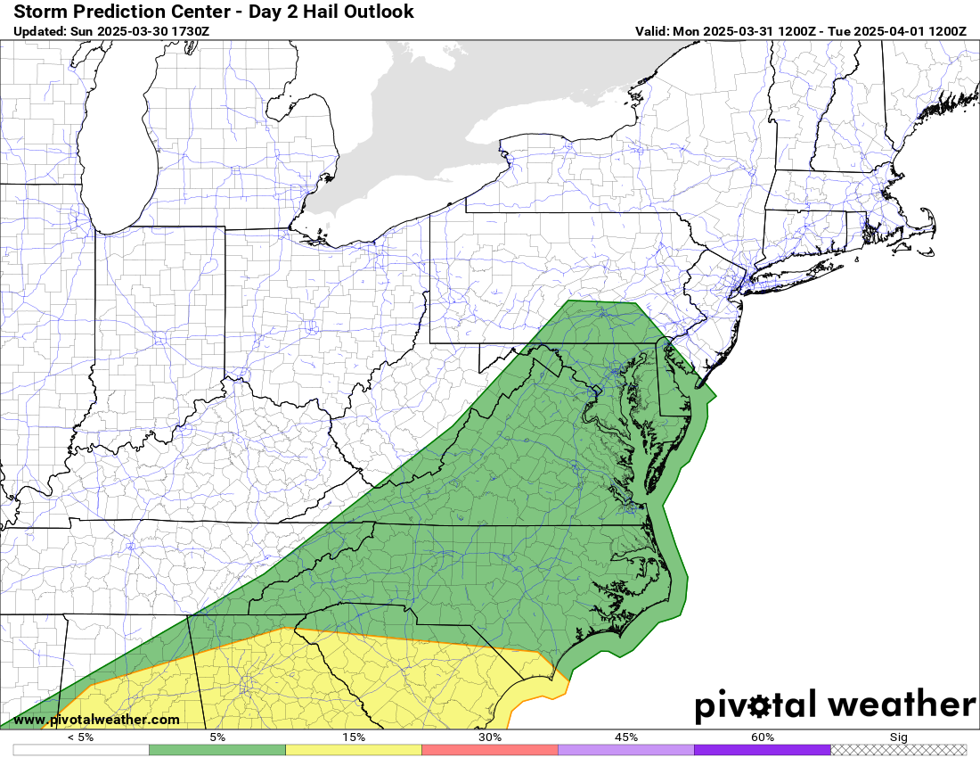
Isolated large hail up to 1” diameter or higher will also be possible.
Continue to follow Rowan County Weather for the latest.