
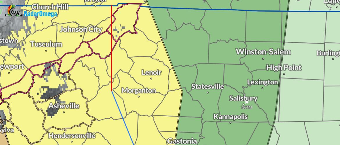
Severe thunderstorms are expected tonight into early Sunday morning
Saturday, March 15, 2025 - 9:12am
Severe thunderstorms are expected tonight into early Sunday morning. The main hazards are damaging winds and tornadoes. A strong tornado or two cannot be ruled out.
➔ Isolated flash flooding is possible, mainly across the southwest North Carolina mountains and the Georgia and South Carolina mountains where rainfall totals will be highest.
➔ Gusty winds develop today and linger into Sunday. Wind Advisory was issued for the southern and central North Carolina mountains from this evening into early Sunday morning.
➔ Thunderstorms may redevelop Sunday afternoon along and east of I-77 but confidence is low.
- The environment will be favorable for tornadoes overnight into early Sunday morning.
- A strong tornado or two cannot be ruled out.
- The environment will be favorable for damaging severe thunderstorm winds (58 mph or greater) overnight into early Sunday morning.
- Locally heavy rain is expected tonight into early Sunday morning. Isolated flash flooding is possible across the southwest North Carolina mountains and the Georgia and South Carolina mountains while nuisance to minor flooding is possible east of the mountains.
- Totals have decreased east of the mountains and increased across portions of the southwest North Carolina mountains.
- East of the Mountains: 0.5” to 1”
- Northern/Central North Carolina Mountains: 1” to 2”
- Southern North Carolina Mountains: 1.5” to 3” with localized areas of 4” or greater across the south facing slopes
- Non-thunderstorm wind gusts will develop today, lingering into Sunday afternoon with gusts peaking tonight.
- A wind advisory was issued for the southern and central North Carolina mountains from 6pm this evening through 8am Sunday.
- Mountain Gusts Inside the Wind Advisory: 40-50 mph across the valleys with 60 to 70 mph across the highest ridgetops
- Mountain Gusts Outside Wind Advisory: 35-45 mph
- Gusts Elsewhere: 30-35 mph
Stick with Rowan County Weather for the latest.