
Severe weather and high winds possible this weekend
A powerful storm system will impact the region late Saturday into Sunday with severe thunderstorms expected.
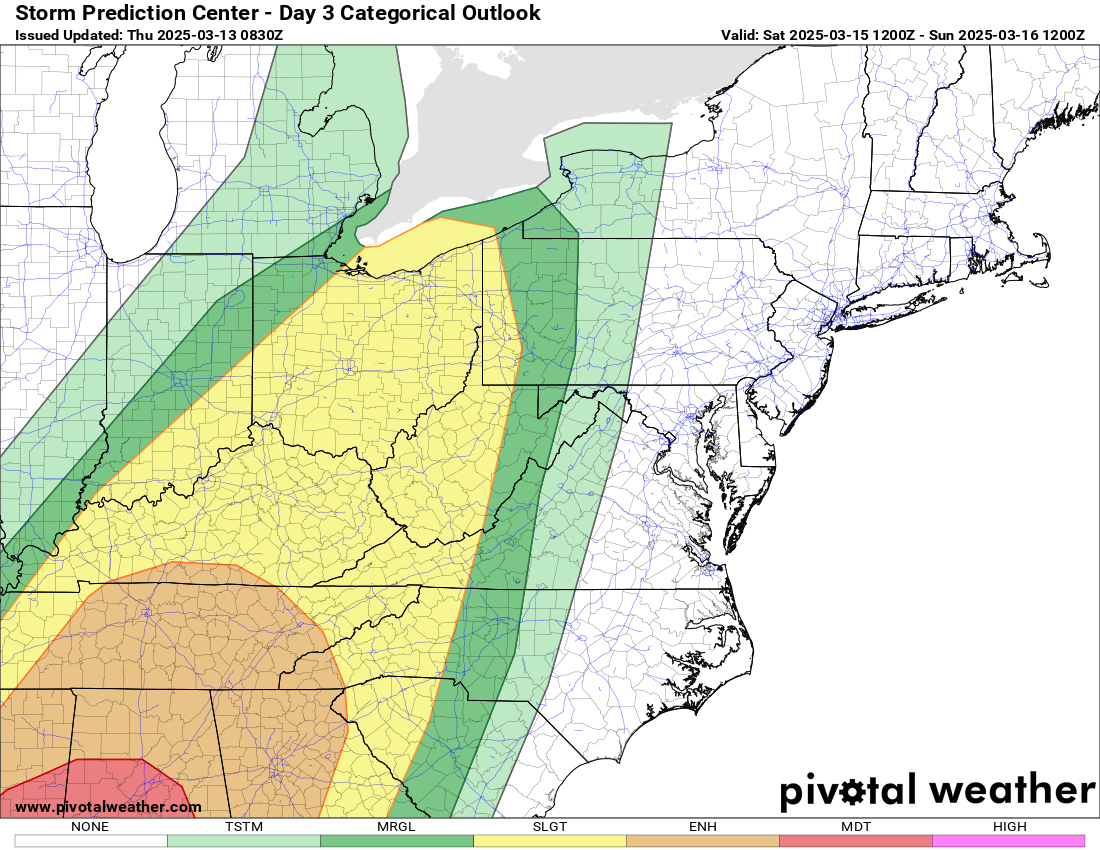
➔ The enhanced risk has been expanded slightly farther east and further expansions are possible.
➔ Multiple rounds of severe thunderstorms are possible with a combination of individual cells and an organized line.
➔ The main threat will be for damaging winds and tornadoes. A strong tornado cannot be ruled out.
Strong non-thunderstorm wind gusts are expected Saturday afternoon through Sunday morning ahead of any thunderstorms.
▪ Wind gusts of 30-40 mph are expected outside of the mountains.
▪ A wind advisory may eventually be needed for portions of the area, especially across the mountains.
Locally heavy rainfall is expected late Saturday into Sunday as thunderstorms move across the area.
▪ A quick 1-2” of rain will be possible with locally heavier amounts, especially where multiple rounds of storms occur.
▪ This may result in minor/nuisance flooding of low lying and poor drainage areas.
Continue to stay update with Rowan County Weather as we head into the weekend with updates on the system as it moves closer to and through the area.
Please let our local sponsors know that you appreciate their support of our blog. Take a moment to visit their website linked at the top of this post.
Share this:

Announcements & Events
Check back often for important announcements and events that I'll be involved in!